RASTRICK FROM THE AIR
AERIAL PHOTOGRAPH TAKEN BY THE R.A.F. IN 1948
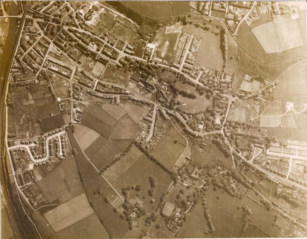
A Crown Copyright photograph of Rastrick from the air on the 17th May 1948.
To get your bearings, the River Calder is on the extreme upper left of the photo and the bridge over the river is Rastrick Bridge at Bridge End with the railway just to the right of the bridge
The circular structure at the top, about one third of the way on is a chimney and kiln at the brickworks under the Healey Wood cliffs.
Oaklands can be seen on the left just over half way down the picture joined by Lillands Lane to the left and Longroyde Road to the right. Go directly to the right across the fields and it takes you to the top of Castle Avenue which was then a dead-end.
The top right is the Knowles Road, Heath Mount Road and Lyndhurst Road area off Huddersfield Road at the top of Bowling Alley, partly shielded by a line of trees.
From the bottom right corner you can see Tofts Grove with Crowtrees Lane above. The ‘new’ prefabs are above there and the quarries and tracks at Southage Quarry between the prefabs and Toothill Bank where you can also make out the bowling green at Rastrick Bowling Club.
To the bottom centre of the photograph are the former grand houses of Rastrick House and Longroyde House in pleasant fields which now form the Foxcroft Drive estate.