A Virtual History Walk
Middle Rastrick
Eventually I hope to post three virtual history walks around Rastrick which will cover upper, middle and the lower part of the township so to start with a Mid Rastrick walk may seem a little unorthodox. There is no reason other than it is the latest one that I have updated and the others may take a little more time.
This walk was first devised some years ago by David Norcliffe for the Calderdale Heritage Walks and a lot of the credit must go to him. Since then, Margaret Sharp and Ian Philp have each led a Heritage walk whilst I have assisted them with some additional material to the original notes. I assumed that I had exhausted most of the research that is readily available but new information just kept on appearing. I didn’t want to go too deeply into any of the subjects but it is probably better to bore you in the comfort of your own home than have you standing on a pavement in the cold and rain, outside some old building, listening to a walk guide rabbiting away. So, let’s go virtual walking.
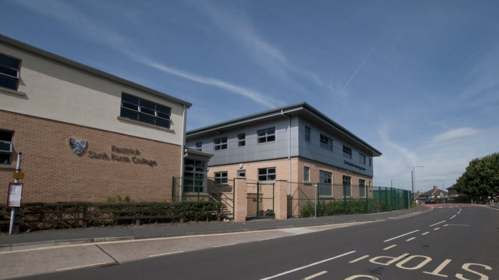
RASTRICK HIGH SCHOOL
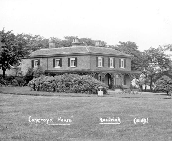
We start the walk by Rastrick High School. Despite being in Rastrick, the area was called Brighouse Closes in the early 1800’s. Much of the land was quarried for the valuable sandstone that lay just beneath the surface in an area known as Longroyd Quarries. Longroyd House, one of several large Georgian houses in the district, was located near to where the school now stands. The Cheetham family were the owners from the late 1870’s, having made their fortune in the silk spinning business in Brighouse.
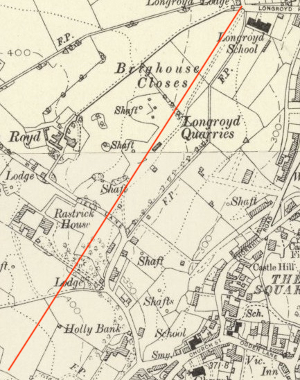
Looking at the map to the left, the red line that runs from the top of Longroyde Road in a south-west direction is roughly the line of the current Field Top Road. On this map we can plot Rastrick High School as being where the words ‘Brighouse Closes’ are shown whilst the three shafts are close to the Nursery School opposite the top of Castle Avenue and Foxcroft Drive.
An interesting difference from the old maps and the current time is Long Royd became one word and then suddenly developed a letter ‘e’ on the end, something not uncommon around this area as there is a constant dispute regarding Bailiffe Bridge, with an ‘e’ or without it .
Building at the school commenced in late 1973 under the authorisation of the old West Riding County Council but by the time the work was completed in 1975, Calderdale MBC had been created and had taken control of education in this area. The school was named Reins Wood Secondary and when the old Rastrick Common School closed in 1976, the pupils were transferred to Reins Wood.
In 1985, Rastrick Grammar School closed its doors when the comprehensive school education system was adopted by the local authority. The grammar school merged with Reins Wood and the new school was named Rastrick High School. Since then, several extensions to the original school have been built and in the mid 1990’s the High School leased an extra thirteen acres of land from Thornhill Estates to extend the playing fields at the rear. Sixth form extensions were added between 2004 and 2011 and the school now has well over 1,400 students.
The former Castlefields Infants School, located next door has been recently renamed Longroyde Nursery School. Along with Longroyde Primary School just a little further down the road, children in this area of Rastrick can be educated from toddler age to eighteen years old, and all within about 400 metres of each other.
Just to touch upon the subject of housing, if you once again look at the map, which is from 1908, most of the fields to the west of Thornhill Road have now been built upon. Just below Longroyde School, the Close Lea estate was built in the 1960’s. Moving diagonally down towards the bottom left hand corner there was Castle Avenue in 1938, the Castlefields estate in the 60’s, Foxcroft Drive estate in the 70’s and Field Lane estate in the 50’s. Rastrick House, Longroyd House and Longroyd Lodges fell victim to the local authority plans so this small area has changed dramatically in the years since just before the 2nd World War.
LONGROYD HOUSE
As we walk up Field Top Road towards the second entrance to Foxcroft Drive you will notice the end of a road called Field Lane on the left which is shown on the map, snaking its way up past Rastrick House to a lodge entrance to Longroyd House (Royd on the map). Looking immediately to the right at that point, there is a narrow path leading up into the Foxcroft estate. This is the continuation of the old Field Lane and would have been used as one of two routes to the house. The other passed by the second entrance lodge at the top of Longroyde Road and followed a very long carriage drive from the north east side. If you look closely at the map you can see woodland copses strategically positioned to the west of the three marked shafts. I say strategically positioned because they shielded the mine workings and the common labourers from the view of the residents of the house. They were all too keen to claim the profits from the workings but didn’t really want to look at them.
Longroyd House, along with Boothroyd, another large palatial house that we now know as the William Henry Smith School, were used to house Belgian refugees, who had fled their country after the German occupation during the 1st World War.
There is more information about the history of Longroyd House near to the end of this virtual walk, when we return to this area.
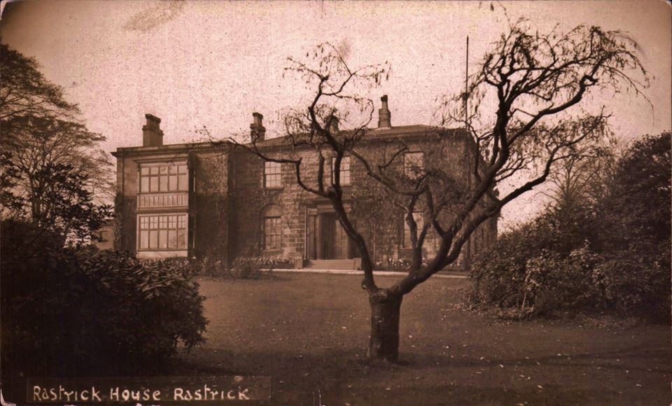
RASTRICK HOUSE
Rastrick House was built in 1813 by John Clay on land which he had bought from the Fryer family. Other owners or tenants included his nephew Joseph and John William Clay. During the 2nd World War the house was used for evacuees from Coventry. It was demolished for the building of the new Foxcroft Drive estate and was located where the second cul-de-sac on the left is now located. When it was pulled down, the cellars weren’t filled in properly. When I lived there in the mid 1980’s my next door but one neighbour decided to dig out the foundations for a garage base. Suddenly, the ground gave way and he fell into an abyss. When he came around, he was convinced he had died and gone downwards instead of up to heaven as the first thing he saw was a fireplace with coal in the fire. He was in part of the cellar kitchen of the old house. The old barn remained at the end of the cul-de-sac until recent years but after much vandalism and several fires, it was demolished and new houses were built on the site. The entrance lodge on Field Lane is still used as a private residence which we will discuss shortly.
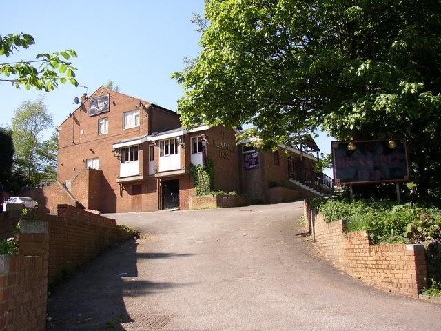
BANDSMAN / BRAMBLE PUB and RASTRICK HOUSE LODGE
Leaving the bottom of Foxcroft Drive, the walk continues to the junction with Field Lane where we turn left. After just a few metres, look to the right hand side and the brick building at the top of the sloping car park is the former Bandsman public house which in later years was renamed The Bramble.
The Bandsman name came about following the success of the Brighouse & Rastrick Brass Band after their rendition of The Floral Dance made no.2 in the music charts at Christmas 1977. The record had been promoted on a daily basis by Terry Wogan on his BBC Radio 2 breakfast show and his listeners throughout the UK went out in their droves to buy a copy. It was kept from being no.1 by the Paul McCartney & Wings massive hit, Mull of Kintyre.
When the pub first opened, the walls were painted with marching bandsmen and musical notes but despite its original success, customers dwindled. The change of name to The Bramble didn’t make much difference and since the doors were closed, it has become increasingly dilapidated. Plans were passed several years ago for new housing on the site but nothing has happened to date and it continues to be an eyesore.
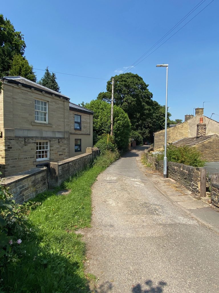
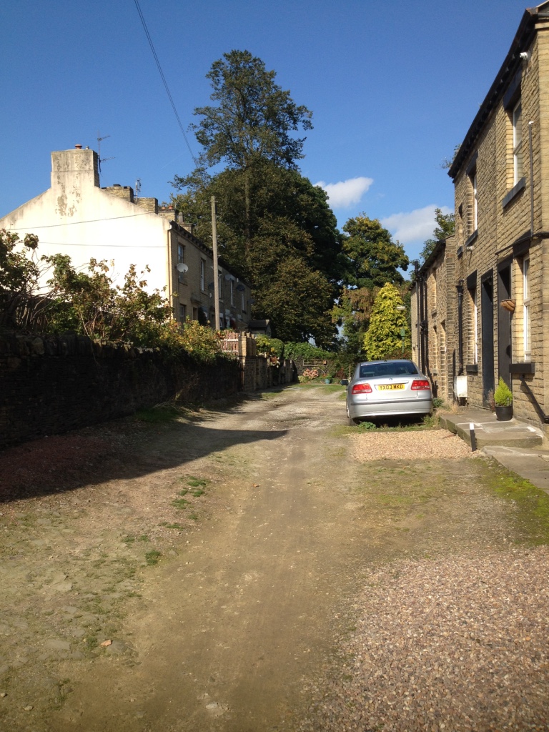
Directly across the road is the former gate-house for Rastrick House, which as previously mentioned, dates from 1813 and is a Grade 2 listed building. A mirror image of the original structure was added in the 1990’s and more recently, further additions have been made to the property. It no longer resembles a lodge house for the former Rastrick mansion.
Two more listed cottages can be found at numbers 10 and 12 Field Lane, just a few metres past the gate-house.
HOLLY BANK HOUSE
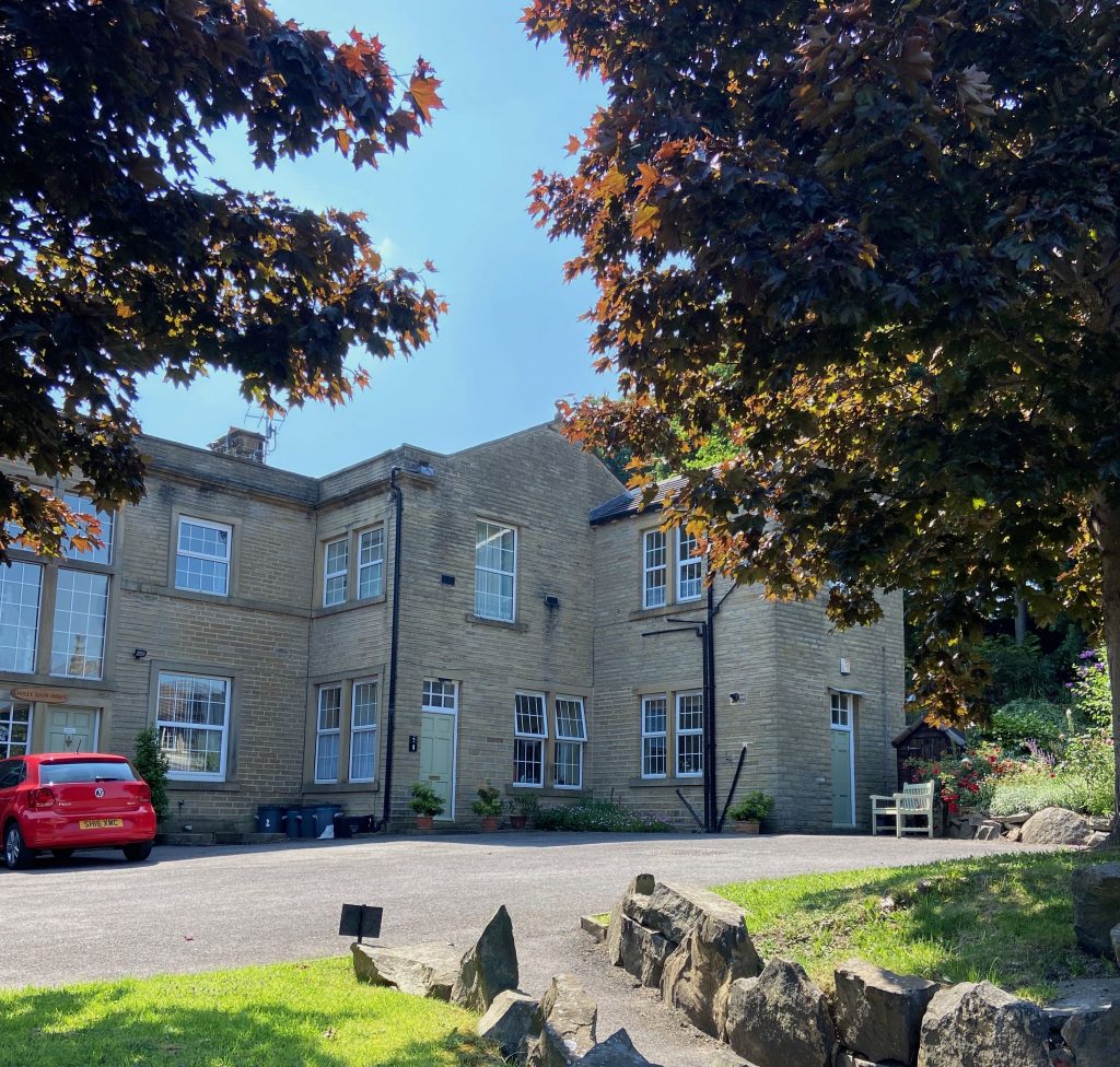
Heading down Field Lane towards the junction with Jumble Dyke and Tofts Grove, we come to Holly Bank House on the right. The site of the present house was previously occupied by a building called Rastrick Hall which was the Manor House for the Manor of Rastrick. It was owned by the Hanson family in 1573 and possibly earlier. In 1685 Edward Hanson sold the property to Thomas Thornhill whose family were to amass a very large estate in Rastrick. In 1809 the Thornhill family sold Rastrick Hall to John Fryer a local Quaker and mill owner who had been their tenant.
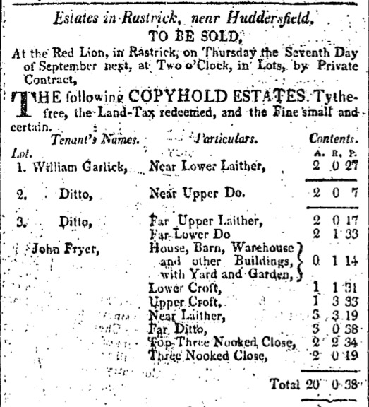
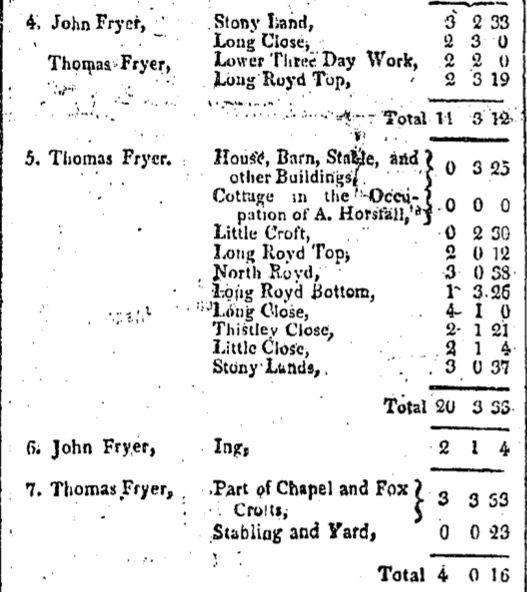
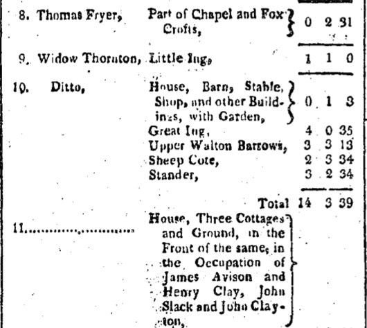
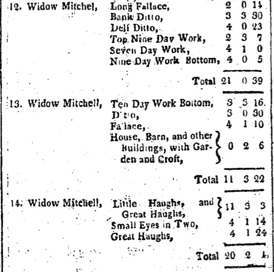
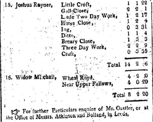
The above is an advert from the Leeds Mercury dated 2nd September 1809 where several parcels of land were sold by Thomas Thornhill. We know that this was Thornhill’s land because at the conclusion of the advert it states ‘for further particulars, enquire of Mr Oastler.’ This is Richard Oastler, father of the more famous person of that name, who was steward for Thomas Thornhill at Fixby Hall.
The details this advert prove that in 1809, John Fryer was already renting land and buildings from Thornhill and when the land came up for sale, he made several purchases, including Lot no.3 which I believe to be the old Manor House/Hall and its out-buildings.
Around the year 1836, the old Hall was pulled down and the present Holly Bank was built by the Fryer’s. Their Georgian house is largely the one we see to-day, though the cellars and dairy date back to before 1836 and may be the last remains of the old Rastrick Hall.
The next owners were members of another notable Rastrick family, the Clay’s who had a worsted business, T. Clay & Sons Limited across the road at Crowtrees Mill. They were also very involved in local government, particularly education. Arthur Travis Clay became the tenant of Holly Bank in 1877 and he added a new frontage in 1882, eventually purchasing the property in 1900. In 1917, it was passed on to his son, Hugh Travis Clay. Hugh married an American lady called Mabel French who rode round Rastrick on her grey horse. She had a pet cemetery in her garden where the dogs were buried. One of them, Cupid, was a particular favourite. She is still remembered by some for selling crab apples from her garden. Towards the end of their lives Mr and Mrs Clay lived in Jersey where Mabel died in 1955 and Hugh died in 1957. Sir Charles Clay, a noted historian and archaeologist, was Librarian to the House of Lords for 34 years. He died aged 92 in 1978.
In the mid 1950’s, the house was owned by Arthur Smith who must have bought it from the Clay’s. Norah Badrock lived at 20 Holly Bank Road and used to walk past the house on her way to St. Matthew’s Church. That was how she first met Arthur. A relationship developed and they married, living at Holly Bank House for many years and bringing up three children there. It was sold after Arthur’s death at which point it was converted into luxurious apartments.
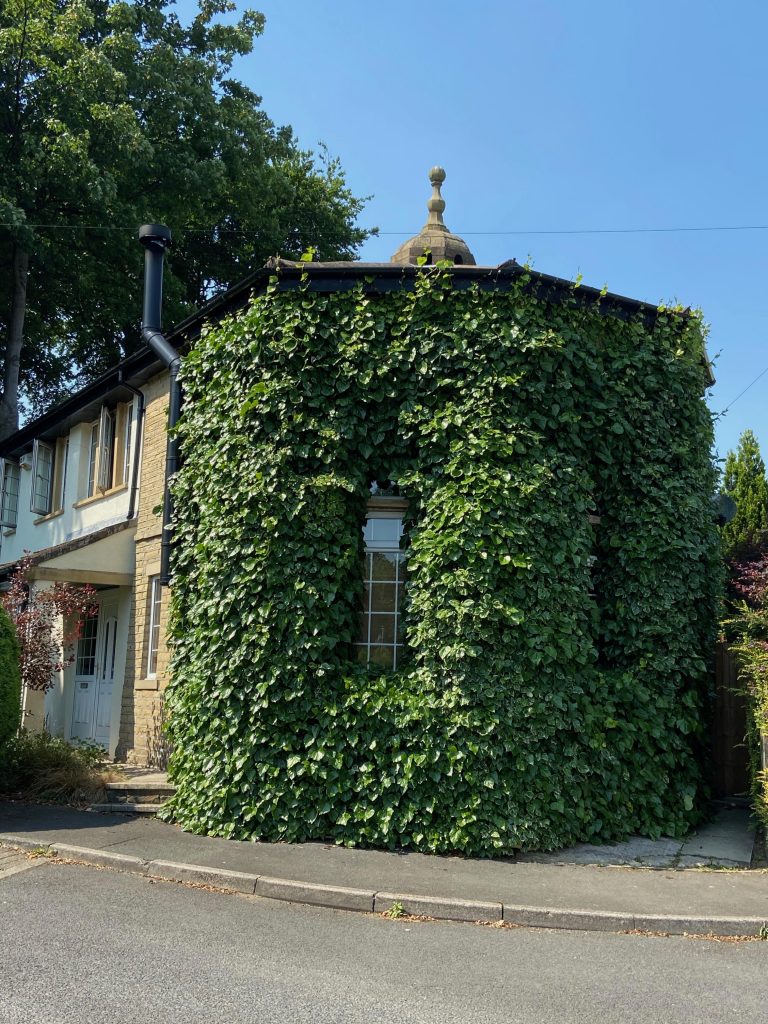
The ivy cladded octagonal building at the entrance was a pigeon cote and seems to pre-date the Georgian house, possibly going back to the days when pigeons were a significant source of fresh meat in winter. I also believe that the barn mentioned in the above advert was not demolished with the hall and is now the building attached to the old pigeon loft. You can just make out the domed section of roof where the pigeons flew in and out of their wonderful home which was probably a better construction than most of the workers lived in. It was converted into a house in 1983-84 and an extension has now been added.
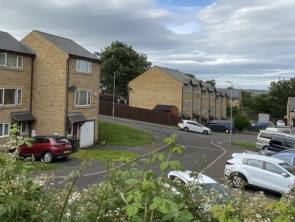
CROWTREES MILL
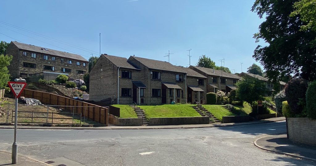
Upon reaching the junction with Tofts Grove and Jumble Dyke, look across to the newer looking houses on top of a raised grass banking (shown on above photo). This is the location of the rear of the former Crowtrees Mill, originally the home of J. T. Clay & Sons Ltd, fine worsted manufacturers. Although many textile mills have been forced to shut down in recent years, this was one of the first to close in Rastrick in 1934.
It was taken over by Sladdin’s, manufacturers of shoulder pads. The business had originally started in 1894 and they moved to Crowtrees Mill after Clay’s had closed down. For the next three decades they supplied vast numbers of shoulder pads to the tailoring and clothing trades. Always known locally as just ‘Sladdins’, the changes in fashion and failure to develop alternative lines forced the company’s closure in the late 1960’s after which the mill stood empty for some years before being demolished.
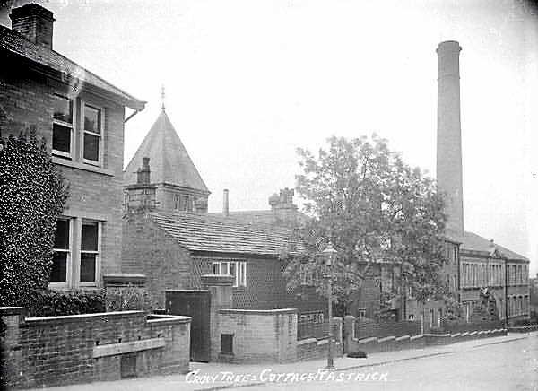
The photograph above shows the mill from the Crowtrees Lane side, where the facade was much more pleasant than the Tofts Grove side. I used to walk past there on the way to my grandparents house for my lunch on two days a week, whilst a pupil at Rastrick Grammar School. They lived at 38, Tofts Grove. Even on bright sunny days, it was always dark and gloomy with the mill on one side of the road and the large trees which housed a rookery on the Holly Bank House side. I can still vividly recall the large fans, high up in the mill wall with their mesh covers, clogged up with dirty woollen fibres. It was quite spooky.

The final photo above is of Joseph Travis Clay. This came from my great aunt’s photograph album. On the reverse, edged in black is his birth and death date. The cards were handed out to the residents of Rastrick as part of mourning process. The people could fondly look at the photograph and pay their respects to this esteemed Rastrick gentleman.
JUMBLE DYKE
As we turn left into Jumble Dyke towards the Top o’Town, look over to left. There are new houses on a road called The Orchards. Someone had obviously done their homework when looking for an appropriate name for the new road through the estate. As many of our older residents of this corner of Rastrick will remember, the area used to be a huge orchard, very popular for scrumping by the lads returning home from the local schools.
Some of these people have memories of Mrs Bott, who lived in the house at the top of Jumble Dyke on the left. She used to sell pears from her orchard but one person has suggested that it was worth walking a little further to Howson’s section of the orchard because their pears were always softer !
On the right hand side was a mixture of cottages and small businesses with a pub, the Lower George part way up (pictured right in modern times). The pub closed its doors in 1925 and one of its claims to fame that I have found was on the 11th March 1811 when farming land to the east of Round Hill was sold there at auction. At another sale, more land at Spout on New Hey Road was auctioned here in 1813. Spout was to become the area where Helm’s mill produced textiles for well over one hundred years.
There was another George Inn, known as the Upper George which was located on the site of the present St. Matthews Church car park. It opened in 1827 and was used for many inquests into deaths of local residents. That inn lost its licence in 1936, the last licensee being Mrs Lizzie Huggett.
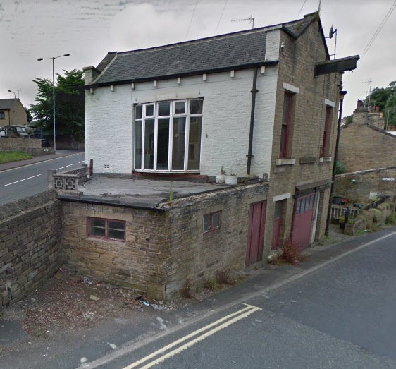
The last building on the right was a branch of the Halifax Commercial Bank from 1909. The bank merged with The Bank of Liverpool and Martins Bank in 1918 and adopted the Martins Bank title in 1928. This branch was only open on Tuesday and Friday from 10-30am to 2-30pm but survived until 1940 when Martins mothballed many of their smaller branches as the workers went off to fight in the 2nd World War. The Rastrick branch never re-opened. It was used by the owners of many of the industrial premises in Rastrick. Company owners or their representatives would converge upon the bank on Friday morning to withdraw money for the wages of their employees. John Riley, owner of a nearby blacksmiths smithy would go and collect the wages for his staff, still wearing his blacksmiths attire but he changed his bowler hat for the visit to the bank.
From the 1950’s, the building was used for many years by Edward Barber, decorator. His great nephew, Colin says that the unusual thing about this building is that it is two buildings yet from outside it looks like one and it is possible to look up between the two buildings and see the sky. On the Jumble Dyke side of the building there was until recently, a large sliding door. Behind it was a garage pit but given the height of the door, it would be a tight fit to get a car in there. Colin wonders whether it might have been used by a blacksmith on carts during pre-motor vehicle days. This is certainly possible as a smithy is shown in the area on one of the old maps from the late 1800’s and there are two blacksmiths in that location who are shown on the census records from the same period. Just what the jib was used for, no-one really knows but it must have been for lifting things from road level to the first floor, where the centre window, now made up, would have housed doors at one time. Edward was declared unfit for service in the 2nd WW due to poor health but he still managed to live to the age of ninety.
The top photograph on the left is of the house where Mrs Bott, the owner of the orchard lived.
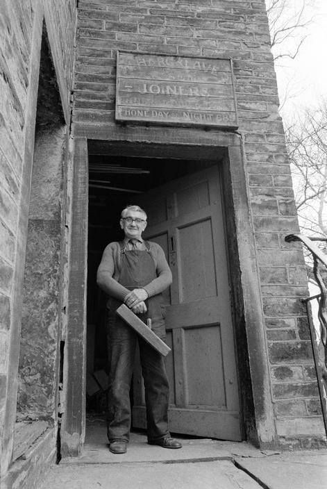
The final picture below is taken by the door at the top of the steps to the right of Mrs Bott’s. This is my old friend Leslie Hargreaves who died in 2010 just two weeks before his 99th birthday. Leslie was a joiner and undertaker but the business was founded by his father, Wilfred around 1909. Leslie spoke with a broad Yorkshire accent and my earliest memories of him were at New Road Sunday School where he was the choir conductor for the anniversary services. As young children, we thought it highly amusing that he shouted at the top of his voice, expressing extreme displeasure at my parents generation, for not getting the hymn tune exactly right, or failing to observe the correct breathing pauses….. it was very professional stuff !
I got to know him properly in later life and often went to visit him at his home in Slade Lane and then latterly in The Cottage residential home just a few metres along Church Street from where this photo was taken. He told me his family were regular worshippers at Crowtrees Chapel and were not very pleased when he told them he didn’t want to attend at that church any more. “I wanted to gooa t’New Roo’ard becos tha ‘ad t’be ont’ register theere t’ lake int’ cricket tee-am.” He was a man with lots of interesting stories, one his favourites being, “did I ever tell thee how I wer wounded int waar.” I was eagerly awaiting his story of a heroic firefight with German soldiers but he went on to tell me that, “I were on’t tram i’ Brussels when this dozy American ‘apeth crashed inta’t’ side o’ tram in a Jee-ap ……not only wor’ he kalied but he’s stolen it too. I wor’ inth’ospital for a few weeks afore bein’ invalided back oo’am. And that were th’end o’ mi waar.” RIP Leslie.
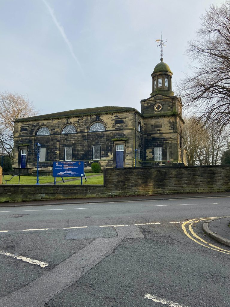
Across the road from Leslie’s workshop is St. Matthew’s Church on a road called Church Street but usually referred to as Top o’ Town. There has been much written about the church and we will touch on briefly upon the history but you can find a concise history written by Richard Kay via this link. On the photograph, look at the weather-vane on the roof of the church tower and hold that in your mind for a while and we will come back to it a little further along the walk.
Just over the higher section of the wall, there is the base of an 11th century Anglo Saxon cross, one of the oldest relics in the Brighouse area. It is thought that the traces of knot-working in the pattern depict interlacing branches from the Tree of Life and that it marked an ecclesiastical boundary or even a Saxon cemetery. It is a scheduled ancient monument and is also Grade II listed. It is very similar to the Walton Cross at Hartshead Church. ‘The first mention of the cross was in 1285 when Hanna del Crosse is mentioned in the Manorial Court Rolls. Similarly, Henry de la Croix is known to have died in 1314 when his son Peter paid taxes upon the death of his father and then sold five acres of land to William de Rastrick. It is thought that both of these people took their name from the fact that they owned land or lived close to the cross. The first known church was built soon after the Black Death of 1349 as John-de-Bretton is recorded as being the incumbent in 1363. He was followed by John-de-Corseley in 1364 and Thomas-del-Cross in 1368.
That building was closed in 1547 during the Reformation but another church was built on the site in 1603 and amazingly, the width, length and height, along with all the costs were recorded. This chapel was to serve the Rastrick community for almost 200 years. The last incumbent of that chapel was the Rev, George Braithwaite who was quite an interesting chap. In 1766 he was in trouble with the Archdeacon when he was reported for ‘neglecting to perform Divine Service in the Chapel… guilty of great profaneness and immorality in drinking to excess…playing cards in public houses and committing the crime of fornication with Mercy Lacey. a single woman”. Despite these slight misdemeanours, the Rev. Braithwaite remained in post and was instrumental in arranging the erection of the current church building which was completed in 1797. After the churchyard was consecrated in April 1798 he became only the eleventh burial at the church following his death in December that year.
The Anglican Church of St. Matthews was joined by the Methodists from Crowtrees in 1969 when Crowtrees Chapel was declared unsafe after dry rot was found in the roof timbers and had to be demolished. At first the two congregations held separate services but they combined into a joint Church in 2007. Some of the money from the sale of the land at Crowtrees was used to fund the building of the new Parish Centre in 1971. This replaced the former church Sunday School, pictured in the centre of the below photograph. It was built in 1865 and was also used a day school from 1867. The school closed in 1912 when the pupils were moved to the ‘new’ Carr Green School at end of Carr Green Lane.
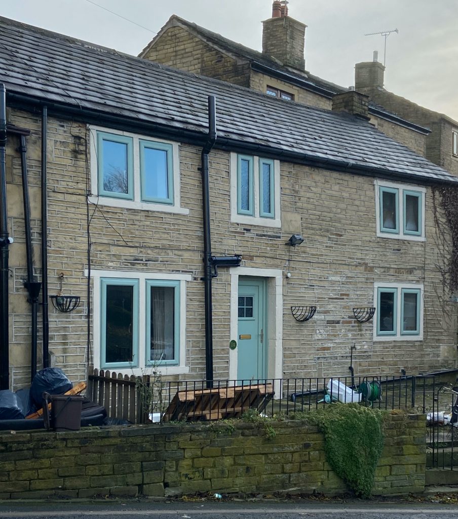
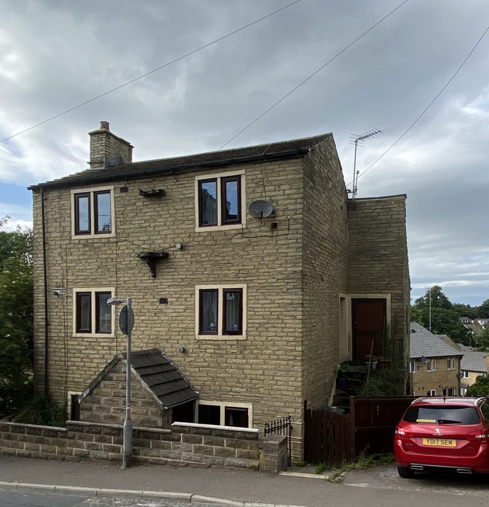
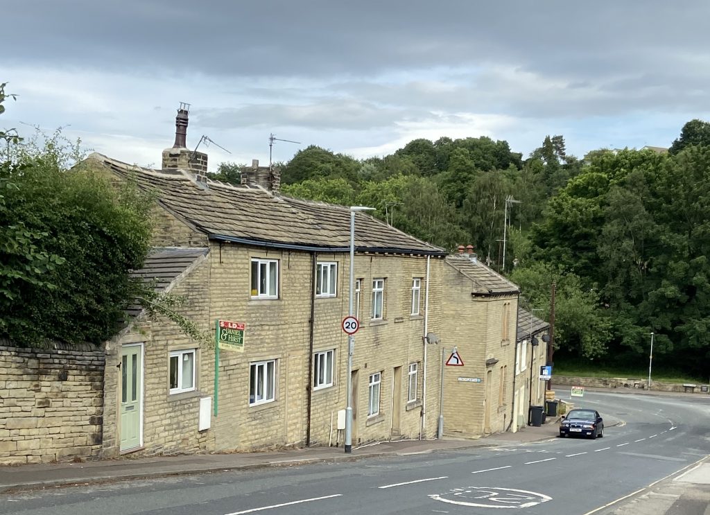
Just along Church Street from St. Matthew’s are two houses numbered 11 and 13. The building started life as just one house and is a Grade II listed building, which may seem a little odd when looking at the frontage from the main road, but it is what we can’t see that warranted the listing. The original house dates from the late 16th century and was altered in both the 19th and 20th centuries.
In the listed building account, the interior of the building is described as having two bays of large scale timber-framing that have survived within No 11, and also in the party wall shared with No 13. The roof is 19th century but has re-used many 16th century timbers. The upper floor retains a stone slab smoke hood but states that this building is listed because it contains an important timber-frame.
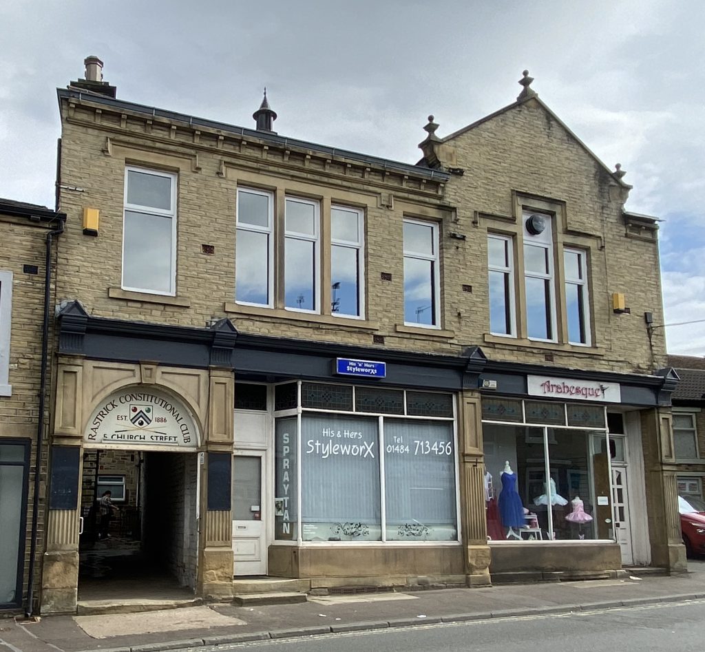
Top o’ Town was a drinkers paradise 100 years ago with not only the Lower and Upper George pubs but the Conservative and Liberal Clubs were also close by, as was the Thornhill Arms public house which we will come to shortly. The only licensed premises to survive is the Constitutional Club which was built in 1886. It is known locally as the Top Club and was until very recently, a men only club. It has done well to outlive all the other opposition.
THORNHILL ARMS
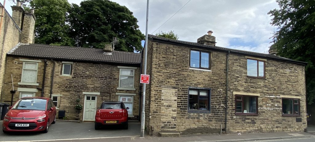
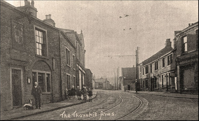
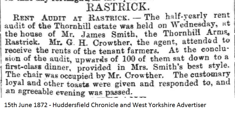
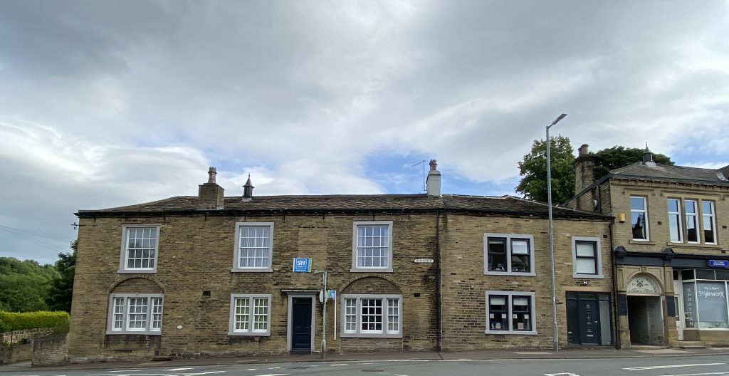
The Thornhill Arms is the building adjacent to the mini-roundabout at the junction with Ogden Lane. It closed in 1938 after serving the local population for over 80 years. The rectangular shape above the front door was once adorned with the coat of arms of the Thornhill family, major landowners in the area. In the mid 1800’s, the Steward of Thornhill Estates would hold a rent audit at the Thornhill Arms where tenants would show up and pay their annual rents for land. There were usually over one hundred tenant farmers who attended and they would sit down to dinner after the collections had finished and swap farming stories (see attachment above). Many societies held annual dinners at the building which could cater for over three hundred diners. There were also many public concerts held at the Thornhill Arms and the famed soprano singer, Mrs Sunderland once sang there. Until around ten years ago, the building was used as a care home for the elderly under the name of The Cottage. Like several similar homes in Rastrick, it ceased trading and lay empty for several years before a private buyer purchased the property and converted it into private apartments.
When you look at Church Street today and compare it with census records from the mid 1800’s, it is hard to believe that so many people lived there. As there were only two census entries for Crowtrees Lane which are known to be a lot further up the road, it would appear that the cottages and houses at the bottom end all came under the Church Street address, as did the houses on Jumble Dyke. In 1851, there are thirty-seven different families residing at Church Street. The range of employment is varied with titles such as letter carrier, joiner, stone merchant, silk winder, butcher, grocer, shopkeeper, tailor, blacksmith, brewer, cabinet maker and farmer to name a few. What is evident is the fact that local residents at Top o’Town didn’t have to venture to other parts of Rastrick to purchase their everyday essentials as just about everything a family would need was for sale locally.
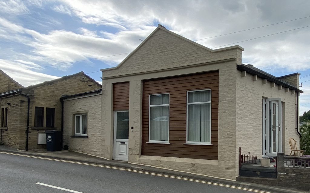
CASTLE HILL CO-OP
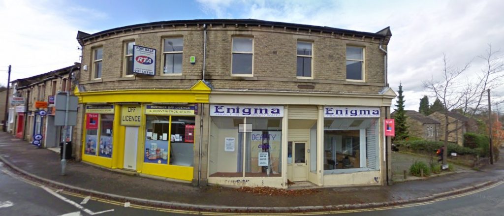
Across the road from the former Thornhill Arms is a curved building that was once the Castle Hill, Rastrick branch of the Brighouse Co-Operative Society. It was divided into two shops and has housed many different businesses since it ceased to be a Co-op store. There have been nail and beauty salons, a carpet shop and off licence to name but a few. It was built in the early 20th century and replaced the original Co-Operative that was opened in 1876 on the land to the right, which is now a car park for the residents of Grammar School Place.
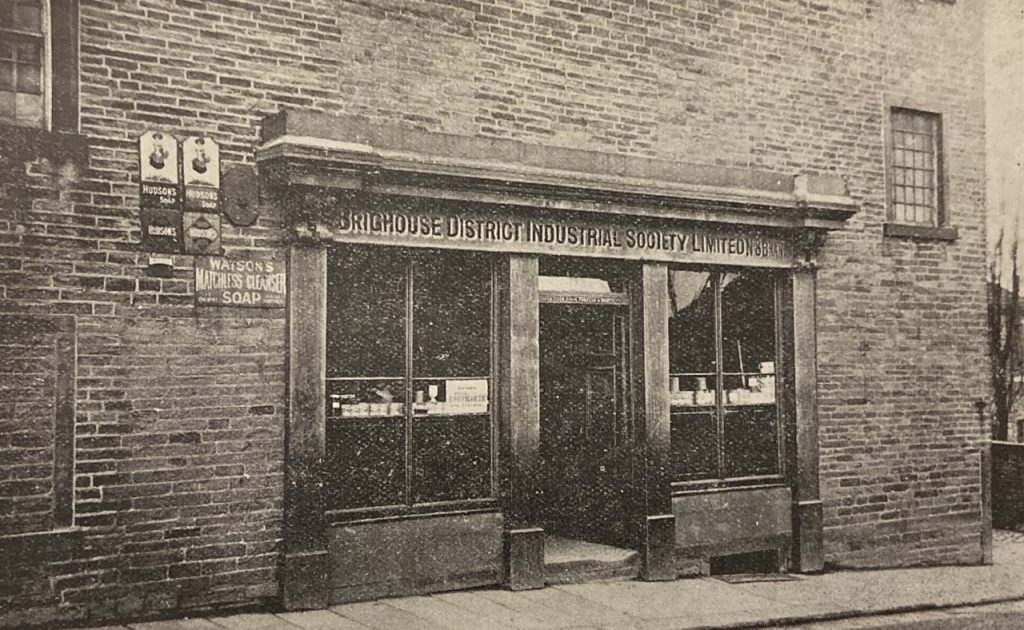
In the book, The History of Brighouse and It’s Co-Operative Society by Jon Caldwell (1899), from which the above picture is taken, you can see the original store but the building was quite old when it was acquired by the Society. Caldwell says, ’in 1876 it was found necessary to have a store in the centre of Rastrick and the Castle Hill property was bought and a branch store opened in that locality. So far as the condition of the premises is concerned, this, at present, is the most unsatisfactory building owned by the Society. It is old and compares very unfavourably with the other stores belonging to the Society. There has often been talk of providing newer premises at Castle Hill but the opportunity does not seem to have come yet.’ It was almost 30 years before the Society saw fit to erect the building we see today. One of the current shop doorways still has the word DRAPERY set into the mosaic flooring at the entrance.
RASTRICK GRAMMAR SCHOOL
There was a school in Rastrick associated with the Church from about 1550 but this seems to have lapsed in the later 1500s. Rastrick Grammar School was founded 1621 when John Hanson left twenty shillings a year ‘for the teaching of a school.’ In 1722 Mary Law left land and property to endow the school and a building on this site was erected soon after. It was rebuilt in 1804 at a cost of £207 to accommodate ninety-eight pupils although there were only had fifty-two on roll by 1833. At that time it was well below the accepted standard of a Grammar School but things improved under the headship of Mr Storr (1860 – 91) and numbers rose to eighty-six.
Over time the hall was built then a laboratory followed. The row of rooms parallel to Thornhill Rd were built in 1910. After WWII the school revived, a 6th form was re-started and by 1970s, the total numbers had risen to three hundred and eighty pupils. A changing room and temporary classrooms were added, and part of Castle Hill House was acquired for a 6th form centre and new staff room.
In Autumn 1985 Rastrick Grammar School merged with Reins Wood School to become Rastrick High School. This site continued in use for one year group which was made up of eight classes. This went on for three more years until extensions could be built at Field Top Road. Once everything had moved to the new location, the Grammar School Trustees sold the site for housing.
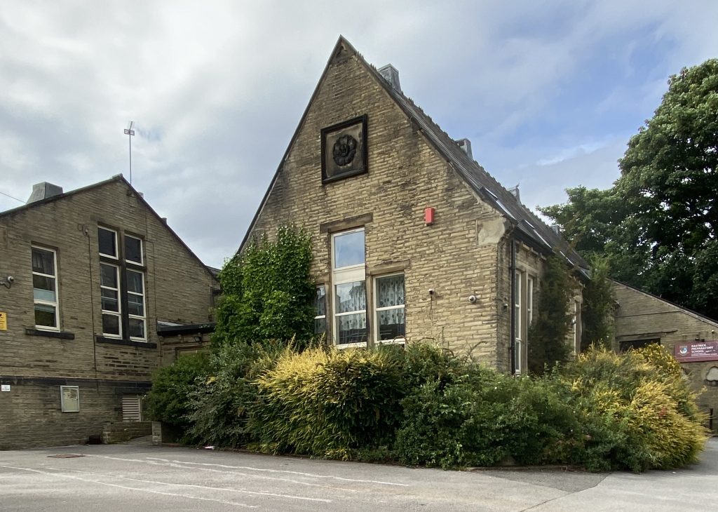
The housing never happened and the school building was re-sold and opened as a private Preparatory and Nursery School in 1994. Ten years later the new school got planning permission to use part of Castle Hill House next door and it expanded widely, offering education from nursery to adulthood, but the success was relatively short-lived and for whatever reason, the school suddenly and unexpectedly closed and remains so to the present day. If you stand on the corner of Thornhill Road and Ogden Lane, looking at the school, the windows looking out onto the road were the chemistry laboratory whilst the floor below (there are steps down to a floor lower than the road) was the physics laboratory, gymnasium and woodwork room.
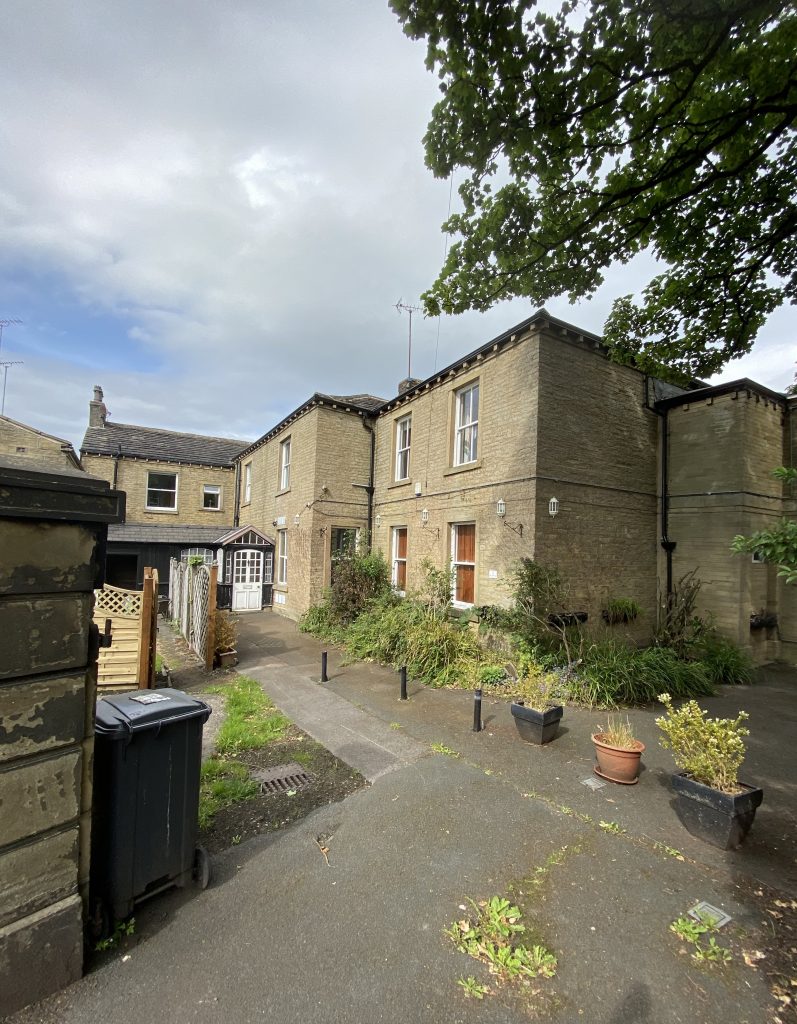
CASTLE HILL HOUSE
Dr. Johnson of Pontefract visited this area in 1669 and wrote that Castle Hill ‘was trenched about and hollow in the middle, as if many stones had been got out of it’. The theory of some historians is that it was the site of a medieval motte, which was a raised earthwork that housed a wooden or stone castle. Motte and Bailey castles fell out of favour around the year 1170. There is also a suggestion that it was built on top of a previous Roman earthwork but the most popular theory is that is was not a motte but a ‘ringwork’ which was a Norman circular entrenchment of a minor medieval castle or manor house.
A Roman coin of Gallienus was found here and urns said to contain human remains were dug up in 1797. For whatever reason, the urns were re-buried and when a local historian bought the house in the mid 1800’s, he went to great lengths to try to re-discover them but despite having almost every centimetre of the garden being turned over in the search and subsequent landscaping, the urns were never found again.
In 1802 the brothers Thomas and Joseph Fryer, local Quaker woollen manufacturers, owned a dye-house on Rosemary Park off Rastrick Common. In 1810 Thomas Fryer bought a block of land and properties from Thomas Thornhill, which included Castle Hill House. He then moved into the premises but both he and his brother died in 1816.
Castle Hill House was re-built by surviving members of the Fryer family in 1832 and shortly afterwards it was divided into two separate houses where two members of the family lived. One of the occupants was Joseph Fryer’s son, Robert, who had married a girl called Mary Barber and it was this marriage that started the Barber connection with the house. Over the next twenty years, the Fryer family gradually severed their connection and the Barber’s took over the whole house.
Joseph Barber was a local solicitor with five sons. The eldest son became a judge, another an archdeacon, a third was an engineer and Henry, who had a passion for fire-fighting, was chief officer of the local brigade. Fairless Barber was a local solicitor and antiquarian who took over Castle Hill in due course. He had a daughter, Margaret Fairless Barber, who was a writer under the pseudonym of Michael Fairless. Her best known work was The Roadmender which created great interest in literary circles a century ago. Fairless Barber died in 1882 and there is a stained glass window at St. Matthew’s which is dedicated to him. After his death, the house was bought by the Clay family though they never lived there and the house was let.
For much of the second half of 20th century it was home to Trevor Williams and his family. From 1970 to 1985, part of it was used as the 6th Form Centre for Rastrick Grammar School but now forms part of the school building that is currently (July 2020) for sale.
OGDEN LANE
Ogden Lane is the main road linking the Top O’Town with Rastrick Common, Toothill Bank and the Bottom O’Town. For many years, the road was busy with horse and cart traffic from the quarries located between Carr Green and Toothill Bank, known as Southages Quarries. This was the only local quarry to remain open after the 2nd World War but is now a distant memory. In the days when the road surface was made of stone setts, it could be quite slippery for the horses hauling heavily laden carts up the steep incline. The carters could carry a large piece of wood fastened to two chains which they fixed to the rear of the cart before starting the ascent. The wood was dragged along behind the cart wheels and if the horse slipped or got tired, the cart was stopped from rolling back down the hill when the wheels hit the wooden block.
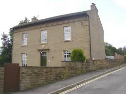
THE VICARAGE
Set back from the road, opposite the former grammar school is the old vicarage which for many years was the home for the incumbents of St. Matthews Church. It was built 1807 and enlarged in 1872. The vicar moved out in 1980’s and the house became the home for a chiropody business but that closed in the year 2000 and it is now a private dwelling. Rastrick Grammar School used to hold a Garden Fete in the vicarage grounds every year. It was probably the only day in the year when I saw the human side of the school masters and we could have a laugh and joke with them.
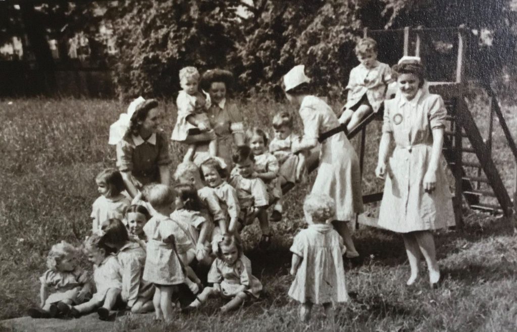
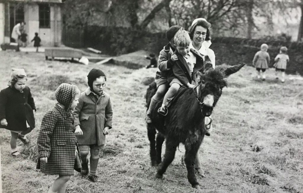
OGDEN LANE NURSERY
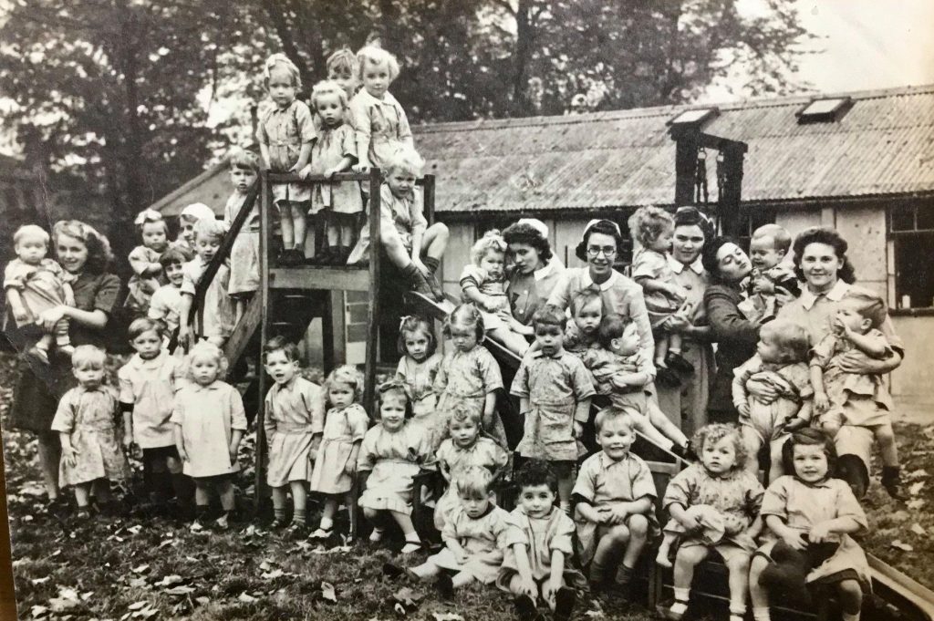
The driveway to the right of the vicarage led to a prefabricated building that in the years following the 2nd World War was used as a nursery. It later became the doctors surgery for Doctor Robertson and Doctor Tong after they moved out of their former surgery at Thorncliffe Villa, Thornhill Road near to the junction with Longroyde Road. The road also led to two temporary classrooms for the grammar school which were known as the Stephenson’s Buildings.
Many people still have fond memories of the nursery and in particular a lady called Nurse Rainbow. The above photographs are produced with the kind permission of Robb Sutton, the son-in-law of (Nurse) Marjorie Rainbow who is still alive and well. They were taken in 1945 and on one of the photo’s is Jenny the donkey. As you can see, having your own donkey at the nursery provided hours of fun for the children.
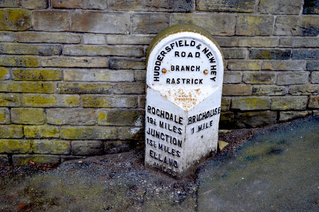
MILESTONE
There is a milestone positioned under the wall of the old Vicarage on Ogden Lane which shows that the road was a branch of the Huddersfield & New Hey Turnpike, provided for in an Act of 1806. The main section of the road is now the A640 from Huddersfield through Salendine Nook, Outlane, Buckstones and out to New Hey in Lancashire. The Rastrick branch arrived in the same year, travelling to Brighouse from Lindley Moor. Both roads were given the name of New Hey Road. The milestone is a Grade 2 listed building which means that it is a building or structure that is ‘of special interest, warranting every effort to preserve it.’ It is an 1893 Brayshaw & Booth cast iron replacement for the original. The Huddersfield & New Hey Trust was dissolved in 1874.
RASTRICK LOCAL BOARD OFFICE, SHOPS and THE POLICE
In January 1863, the Rastrick Local Board was was created. This was the local council of its day which dealt with similar matters to that which a local authority does today. They were responsible for things such as education, gas supply, road maintenance, planning, waste removal, policing etc. You may have come across the name ‘Board School’. This was the name given to many schools in the area because they were set up by the Rastrick Local Board and the teachers were employed them. Prior to 1863, local issues had been dealt with by the Highways Surveyors and Overseers of the Poor. The new Local Board acquired four of the five houses on the left hand side of Ogden Lane between the grammar school and Stackgarth. The bottom two houses were their offices and on the photograph above you can make out the noticeboard between the door and windows of the second building up from Stackgarth. In addition to the offices, Rastrick’s first library was located here, prior to the current one on Crowtrees Lane that was completed in 1912. Various people rented the two properties above the offices whilst the top building was the accommodation for the grammar school headmaster and then latterly, the school caretaker. Despite the Rastrick Board being incorporated into Brighouse Council in 1893, the offices remained open until the 1930’s at which point they were sold.
Returning to the photograph, you can see that the building above the Local Board offices has a sun-blind over the window. It had become a grocery and confectionary shop and in 1939, it was owned by Emily Parratt. She ran the shop for many years after that, eventually moving it into the top building nearest the grammar school whilst converting the former shop into her house. She was affectionately known as Ma Parratt to all the lads from the grammar school and is still remembered by many people. She would sell cakes and sweets to pupils from her back garden which overlooked the bottom of the playground. Miss Parratt was born in January 1890 and never married. She was the daughter of Sam and Thirza Parratt. Sam was the owner of a small slate quarry that made stone roofing-slates, a precious commodity nowadays but which adorned the roofs of all houses in those days. She died in 1974, the year after I left Rastrick Grammar School but up to then, she would split a packet of ten cigarettes and sell them individually to pupils, along with a couple of matches. She was never one to turn down a chance of making a profit.
Again returning to the old photo of Ogden Lane, you will notice a small doorway at pavement level, just before the turning into Stackgarth. You can still see it today but again, like the doorway above, it has been made up with matching stonework. What was this doorway used for? Upon the commencement of the Rastrick Local Board in 1863, they decided to employ a police constable. He was part of the West Riding force, Morley Division (Brighouse was a sub-division of Morley in those days) but it was deemed impractical to have all the police officers based at Brighouse when Rastrick had such a large population and its own fair share of miscreants. The first name I have found was that of PC Bracewell in 1864. He lived at 13, Stackgarth which was the home to local officers in Rastrick for over 50 years.
If the constable came across any drunks or trouble makers in the local pubs, he would throw them through the small doorway into what was known as ‘Th’owd Towser’ where they could either sleep off their drunken stupor or contemplate their wrong-doings. Dependant upon the nature of the crime, on the following morning they were either sent packing with a warning or were taken before the magistrates who listened to the facts about their wrong-doings. It was not the kind of place where you would want to spend the night in winter. Miserable, damp and cold and yet the arresting constable slept soundly in his bed at home, just a few metres away.
Number 20, Ogden Lane is the house on the opposite corner of Stackgarth to the Local Board offices and was built by George Shaw Whiteley, the owner of the smithy at the bottom of the road. It was completed around 1896 and George lived there until 1913 when he retired to Blackpool where he died in 1915. It was at this time that the West Riding Constabulary bought the house and the local Rastrick policeman removed from Stackgarth to what became a small police station cum house. It was used by the police until the 1960’s. The last police occupant was Sgt. Eric Fairbank who moved from there to his new home at Stratton Road in December 1966 where he lived next door but one to my parents. The police then sold the house and it has been a private dwelling ever since.
STACKGARTH
The first houses on Stackgarth arrived around the 1840’s and the road is shown on the 1854 map of Rastrick. A local builder, James Dyson, built some further houses there in 1862. His cousin William had returned from Ireland with his pregnant wife Mary Ann and their young daughter Mary. They were living in lodgings with another family at Bridge End but after their son, Archibald was born in December 1963, James offered to rent one of the Stackgarth houses to the family.
It appears that Mary Ann, who had left her family back in Ireland, was suffering from what we now know as post-natal depression. On the 14th April 1864, after seeing her husband off to work and making the children some breakfast, she inexplicably murdered her son and daughter by cutting their throats with a sharp razor. She then ran to the home of the above mentioned PC Bracewell at 13, Stackgarth and confessed to what she had done. There is more of this story on this website at:- https://myrastrick.com/double-child-murder/
G.S. WHITELEY’S SMITHY
The house numbering on the right-hand side of the road when travelling from the bottom of Ogden Lane to the Top o’ Town started at number 2 and rose in even numbers until the final house below the grammar school which was number 30. The bottom house is number 14 and number 12 was at the rear. These four houses were owned for many years by the Trustees of the Mary Law Endowed School (Rastrick Grammar School trustees). Numbers 2 to 10 were on the bottom side of the entrance gates to the smithy. There is no record of anyone ever having lived at number 2 Ogden Lane and it was described as a shop and stable in the 1910 tax returns and formed part of a block of three buildings on the land where new houses have recently been built, opposite the Junction Inn. Number 4 was a fish and chip shop in the early 1900’s. Number 6 was a small house of just two rooms, located around to the rear whilst number 8 was another small two roomed house on the right of the entrance to the smithy. All three properties were owned by Brighouse Town Council in the early 1900’s. Number 10 was only ever used as a coal staith and stable after Joseph Whiteley, the father of the previously mentioned George Shaw Whiteley, took over the business in 1860.
The smithy was known as G.S. Whiteley’s up to it’s closure in the 1990’s but George Shaw Whiteley didn’t have any sons to take over the business. His sister Ellen had married into the Riley family and her son John worked for the company as a blacksmith from a young age. John Riley was 30 years old when his uncle George passed away and John took over the business, later followed by his son, Clifford. Earlier, I asked you to remember the weather vane on top of St. Matthew’s Church. It was Clifford Riley who made the weather vane and then fixed it onto the church in the 1950’s. All credit to his fine workmanship as almost 70 years on, it still adorns the domed roof of St. Matthew’s. Clifford wrote a book about his life at the smithy entitled ‘A Village Blacksmith’ and it is well worth a read if you can get your hands on a copy. Like his father, Clifford was a well built man of pure muscle and was as strong as an ox. In his book he talks of how he would lift a three hundredweight (152 kgs) anvil from the floor and onto its block. Now that requires some strength !
Much of the work at G.S. Whiteley’s, especially in the early days, was the production of tools for the local stone quarrying industry which, being located so close to Southages Quarry which was just across the road, it was easy for the workmen to get their tools repaired or sharpened without having to travel very far. The high quality Riley brand chisels are still made in Rastrick today after R.H.& G Travis https://www.stoneworkingtools.co.uk acquired the rights to produce them at their forge on the junction of Birds Royd Lane and Huddersfield Road. Riley tools even gets a mention on the Stone Specialists website:-
https://www.stonespecialist.com/news/equipment/report-hand-tools.
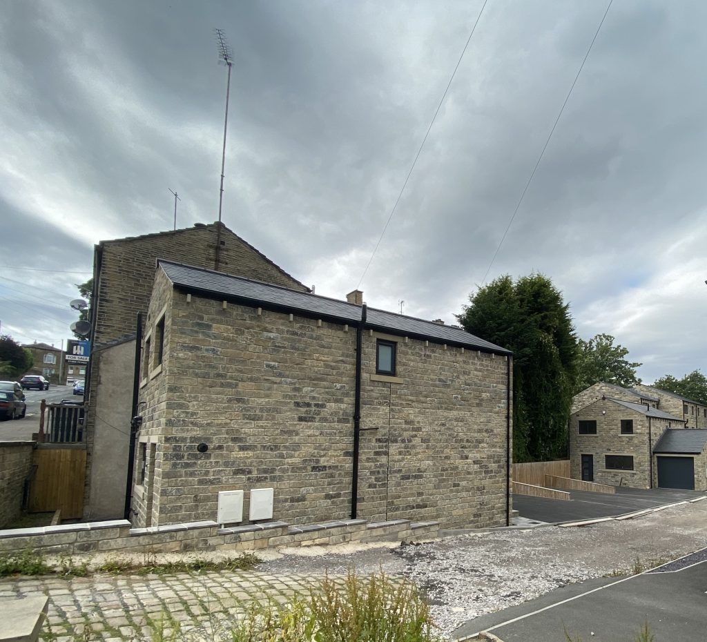
After the firm closed, the smithy was demolished and the land was laid to waste for quite a while but as is happening in many areas of Rastrick nowadays, planning permission for dwelling houses was approved, the land is sold and the building contractors move in. The above photo shows the new houses where G.S. Whiteley’s smithy stood for almost 150 years.
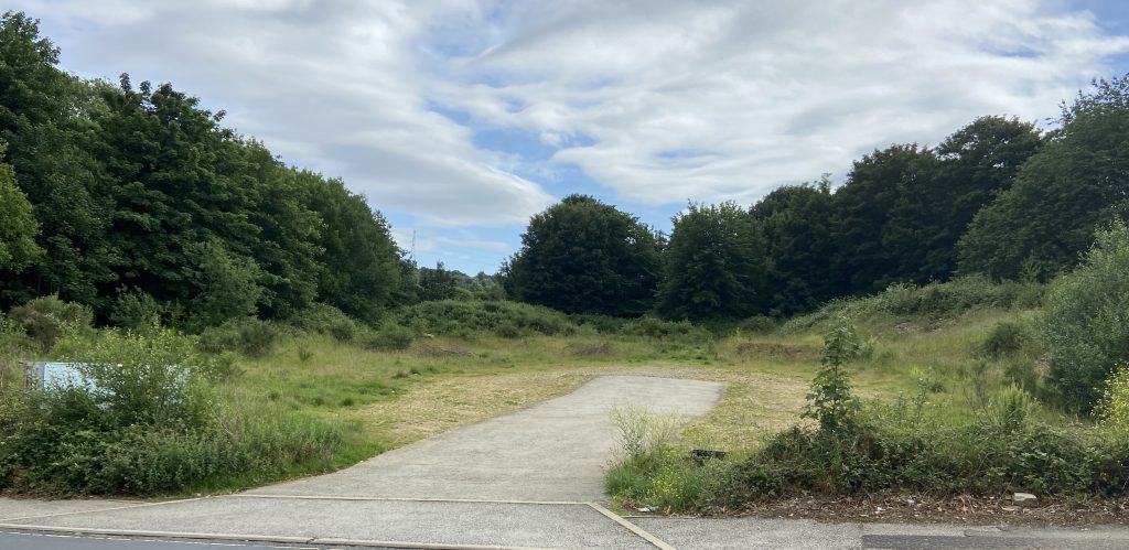
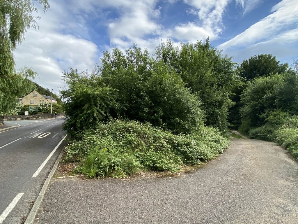
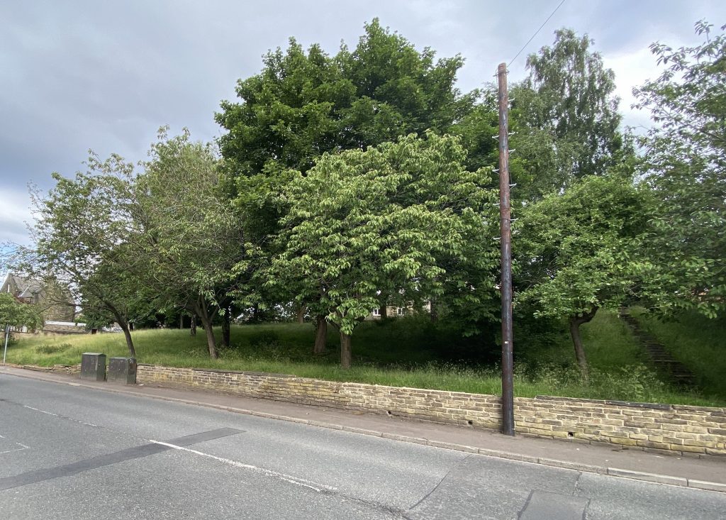
After Southage Quarry closed down in 1955, the land adjacent to Ogden Lane was used for allotments for a few years. I can’t imagine the soil was very good and eventually the allotments closed down and moved onto land at the rear of Oaklands off Lillands Lane. Nature took over the area and trees and weeds grew in abundance. The land was eventually sold to a local property developer but all that appears to have happened is that the stone wall and trees have been removed. It remains overgrown except for a parking area that was created a few years ago. I expect houses will be built on the site eventually but with the knowledge of many underground shafts running in all directions approx. 30 metres below ground, I wouldn’t really want to buy one myself.
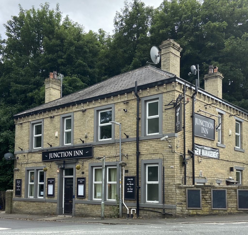
JUNCTION INN
The Junction pub is first shown in the 1861 census when John Charlesworth was the licensee. In 1881, his son James had taken over the licence.
In 1923, one of the last tram tracks to be laid in the West Riding of Yorkshire was between Huddersfield and Brighouse via Rastrick. A triangular reverser was fitted outside the Junction which allowed some trams that had come up from Brighouse, to turn around easily and go back again without too much of a problem. This shortened service was only used at busy times, bringing people home from the mills and factories at the end of the working day. The ‘reverser’ meant that the water fountain (pictured left) in the middle of the road at the bottom of Toothill Bank and Ogden Lane had to be removed.
The tram only lasted for seventeen years on the Rastrick route as they were replaced by the electric powered trolley bus in 1940. Their life was even shorter as the bus service superseded that in 1955.
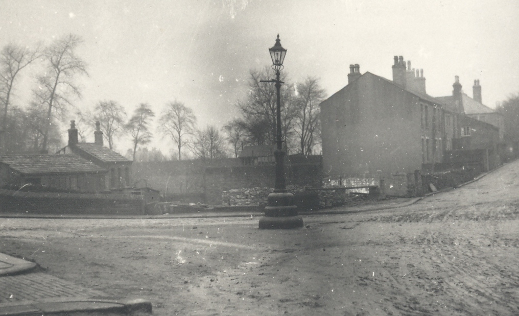
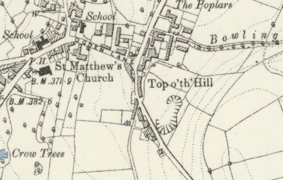
TOOTHILL BANK
At the bottom of Toothill Bank was a block of eighteen back to back houses in an area known as Top o’th Hill. Why it was called that I have absolutely no idea as it is nowhere near the top of a hill. On the above map, just up Toothill Bank and below the words “Top o’th Hill is the old opencast quarry which became the Rastrick Public Subscription Bowling Club in 1902. On the opposite side of the road was a track leading to Southages Quarries from where excellent quality sandstone was mined until 1955. There are further details about the quarries on this website at:- https://myrastrick.com/quarrying-at-carr-green-rastrick/
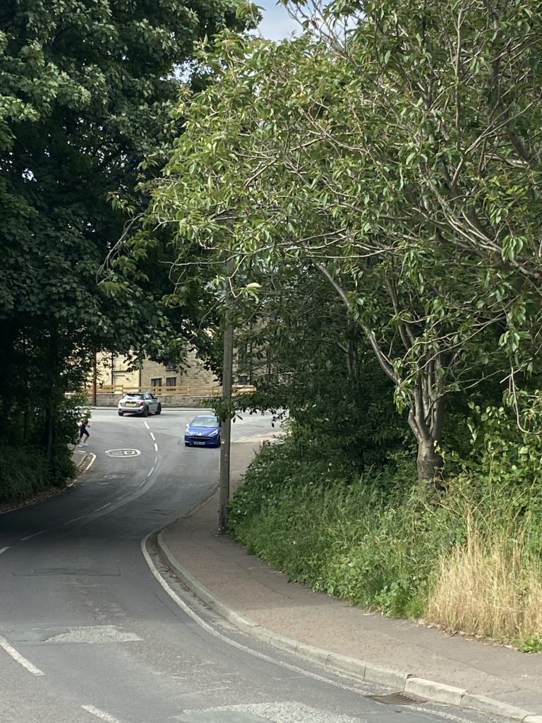
The photograph to the right shows the overgrown road side between the pavement and the track leading towards Bowling Alley where the houses known as Top o’th Town once stood.
Quarry Road, as it was called and the houses on Toothill Bank and Toothill Bank Place on the top side of the junction with the track, consisted of another forty-one houses in 1851 therefore the total population of that small area of Rastrick was around two hundred and sixty people. Some will remember that when the houses were demolished in 1970, an old waterwheel was discovered under the stone slab flooring of one of the houses. I recall going down to look at it, along with other pupils from Rastrick Grammar School before it was covered over again. It was reported at the time that the wheel was part of a small tannery that once existed there in the early 1800’s.
Mr & Mrs Hammond are remembered by some older people. Mr Hammond had a small holding at the top of Quarry Road near to Carr Green Recreation Ground, which was later taken over by Gordon Riach who kept pigs there. Roger Thompson says that ‘if we bumped into him up Quarry Rd he always wanted to know what we were up to. We lied.’
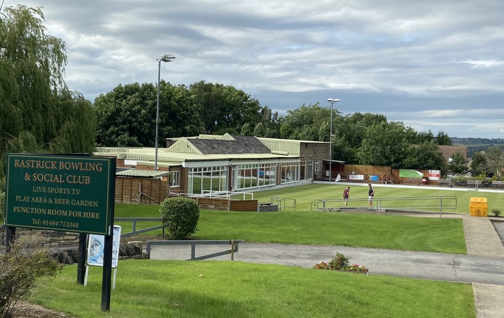
The left hand photo above shows the area just below the Bowling Club on Toothill Bank where the waterwheel was found in 1970 whilst the right hand picture is of the Rastrick Bowling Club, built on land that was formerly a stone quarry.
DELVERS ARMS
Not surprisingly there was a small beer house in one of the houses. It was called the The Delvers Arms and the licensee was Thomas Lofthouse according to Pigot’s Trade Directory of 1828-29. In the 1881 census, Henry Bentley was the landlord but they are only two references to it that I have found. No doubt it helped to quench the thirst of the parched delvers from the local quarries, who occupied the nearby houses.
BOTTOM O’ TOWN
I remember the houses and shops that stood on what is now a grass banking with mature trees at the Bottom o’ Town. I can also clearly remember when they were pulled down. The year was 1973 and I recall it so well because that was the year I left Rastrick Grammar School. After our last day at school, several of ‘us leavers’ threw our school ties into a fire at the bottom of Bowling Alley, where the demolition men were burning the old timbers. Just before they closed, there was a shop run by the parents of my friend Graham Swallow. Many will remember his sister Jenny who used to ride horses in the fields behind, adjacent to Bowling Alley. I also recall a fish and chip shop at that location with very high ceilings and a high counter…. or was I just small?
Roger Thompson can go back a lot further than me and says that ‘Bottom o’ Town was a great place to live all those years ago. Mrs Leah’s shop, John Riley’s blacksmiths, Mr Tidswell’s hens running free, Harold Muir’s pony and cart trotting by, same time every day. Bonfire behind the Junk (Junction Inn) every year. Barbers hut, all those tin cigarette signs. Worth a small fortune now. Even had a fish n chip shop. 9d for for fish & chips, I can go that far back. Times spent under the gas lamp by the steps across from the Junk as kids. Steps are still there. Surrounded by green fields. God we were so lucky. You can just make out the steps that Roger is talking about on the extreme right of the picture above.
It’s strange how people remember those old days so fondly when times were actually quite hard. Roger goes on to say, “our house had gas lighting at Bottom o’Town whilst next door either side had electric. My mother got electricity in about 1961 along with a new gas fireplace. That old range we had would be worth a bit now.” And Roger says they were ‘so lucky’ to live there. I don’t think todays generation would agree.
BOWLING ALLEY AND BOWLING ALLEY FARM
Bowling Alley is an ancient track leading from Rastrick Common up to the Healey Wood Road/Knowles Road area. It dates back several centuries and is shown on the 1824 Rastrick map. It hasn’t altered a great deal during its lifetime and although now closed to traffic, it is used regularly by pedestrians. In 1675, the Rev. Oliver Heywood of Northowram rode through Rastrick and noted in his diary, “Just by upon the common they have walled in a large bowling green”. Of course, crown green bowling still continues nearby at the Rastrick Bowling Club but just what kind of bowling took place near Bowling Alley ?
Bowling was a game strictly for the upper classes. Early drawings and paintings of the game appear to show a form of skittles rather than the game we know today. Henry VIII banned the common people from playing bowls but they were given a special dispensation and were allowed to play on Christmas Day. Henry VIII’s law of 1541 wasn’t officially repealed until 1845 but no-one was ever prosecuted for the offence after his death.
Mr. Philemon Aspinall was a well respected textile manufacturer who resided at Bowling Alley to the rear of Bottom o’Town. In 1861 his brother Edwin lived next door. He also worked in the family business which employed twenty men in a small mill situated nearby.
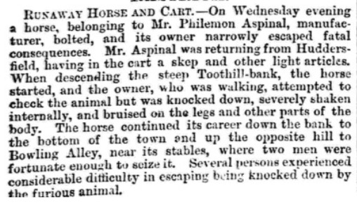
In 1868, Philemon had a lucky escape when descending Toothill Bank on his way home from Huddersfield. He was walking his horse and cart down the steep hill when the horse suddenly bolted and knocked Philemon to the ground causing bruising to his body and legs. The horse ran down to the bottom of the hill almost knocking several other people down before making its way home to its stables on Bowling Alley where it was brought under control.
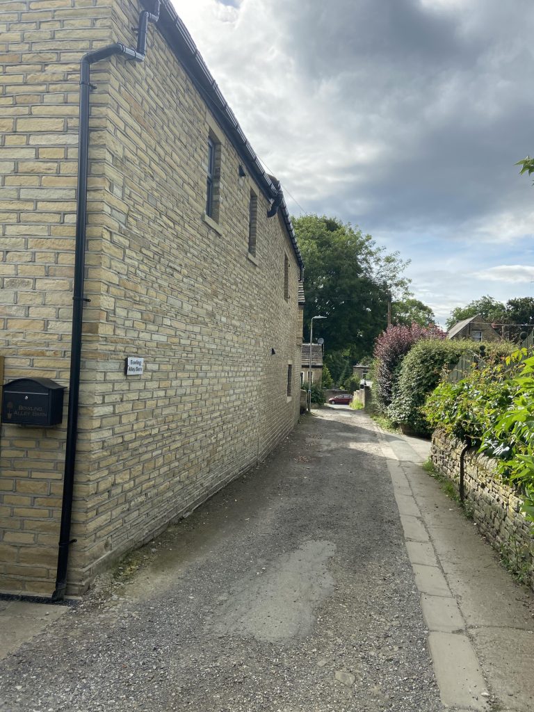
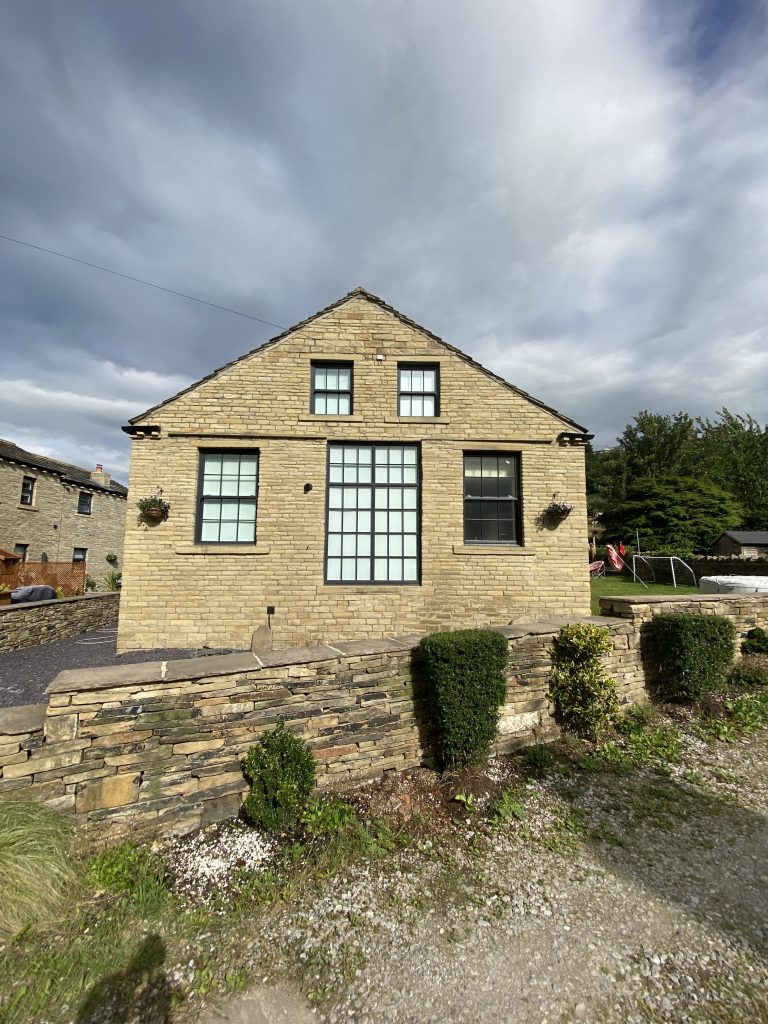
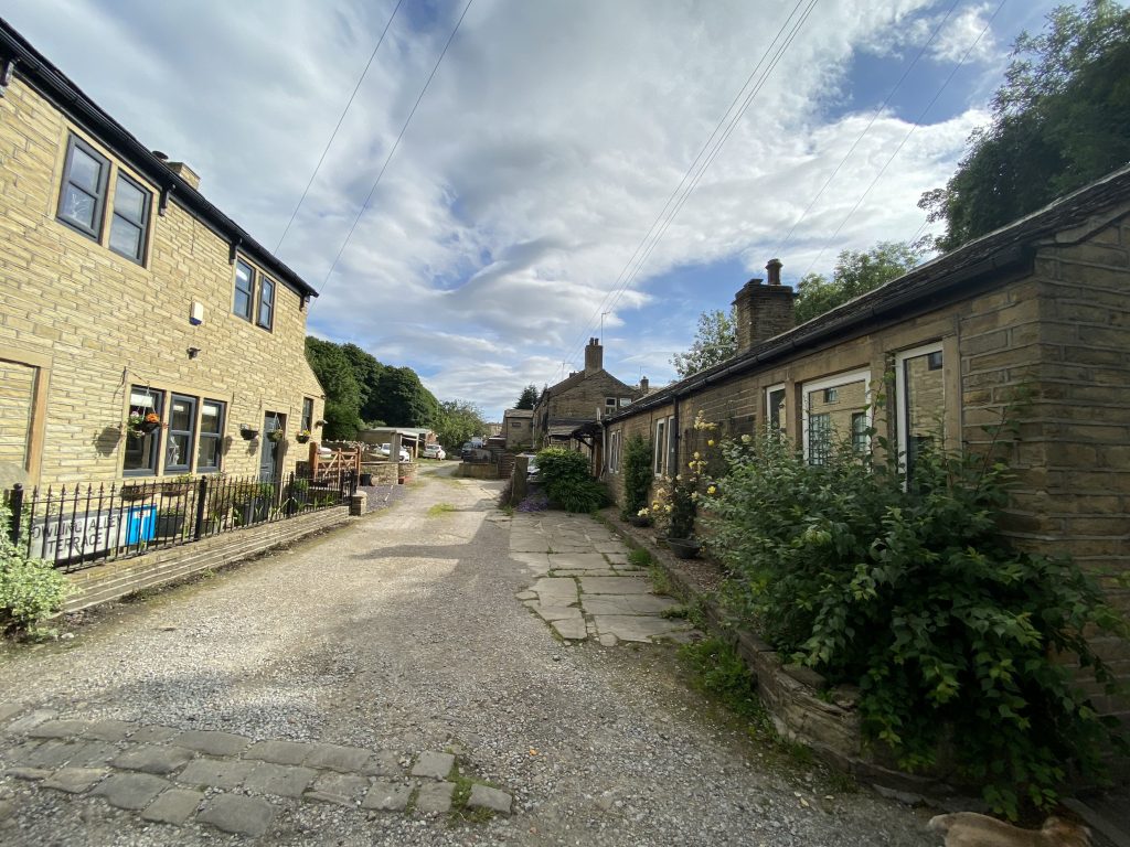
A short distance along Bowling Alley is a former barn that belonged to Bowling Alley Farm and dates from 1760. This makes it one of the older buildings in this area of Rastrick. It was converted into a house in the 1960s. In addition to the sprinkling of houses and cottages on Bowling Alley Terrace, there are more old buildings, just above, on the right hand side of Bowling Alley is a former mill which has also been recently converted in a private house.
On the 17th May 1847, a sale of much of the land in this area took place at the Thornhill Arms public house at the Top o’Town. The land included five cottages and a three storey dwelling house which had been divided into two and was occupied by brothers, John and Edward Broughton, textile manufacturers. In addition to the house and garden, an adjoining barn, mistal, shed and outbuilding, also occupied by the Broughton brothers, as was a stable and yard, outbuildings containing, drying stove, tenters, singeing and warping rooms, press shop and cart shed, occupied by Joseph Jowitt Fryer and his brother, Charles. There were other buildings around what was described as valuable grassland and close called Bowling Alley. There was further land called the Scholey’s (hence the name of Scholey Road and Avenue), leading down to Healey Wood or Hilly Wood as it is shown on the 1824 Rastrick map including a mill at Rosemary, which we will come to shortly.
There was certainly a fair amount of farming and industry going on around this now quiet and pleasant area of Rastrick.
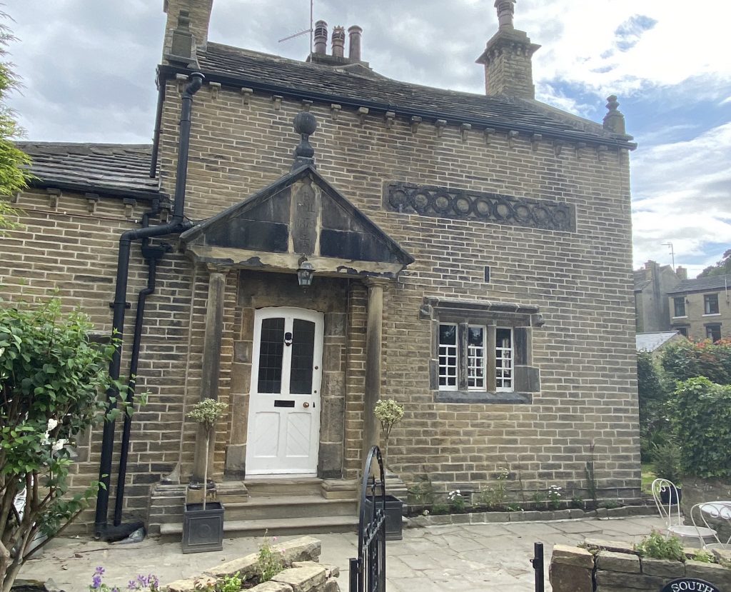
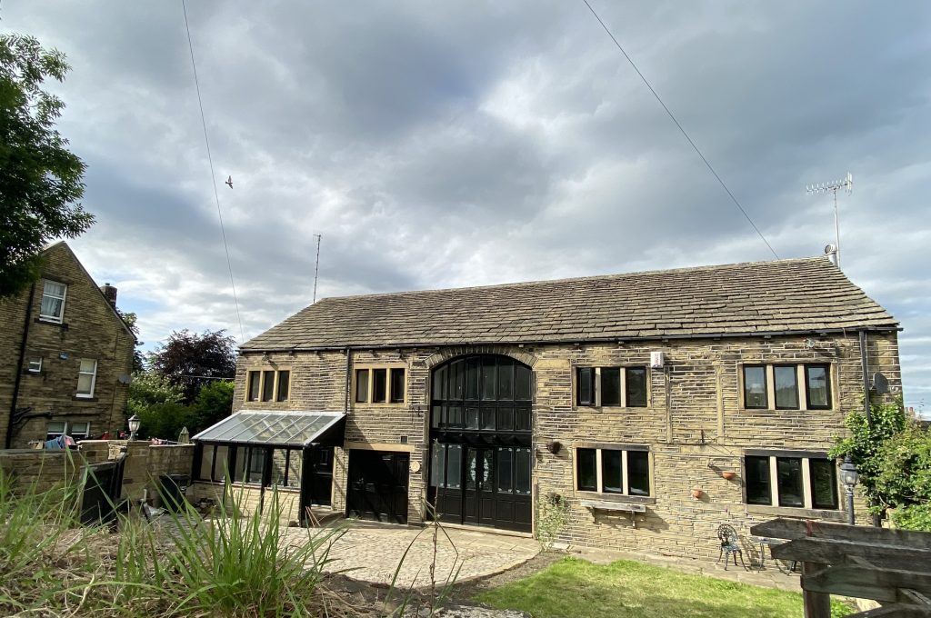
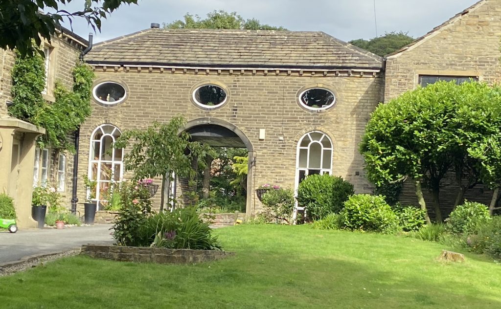
SOUTH LODGE, RASTRICK COMMON
Across the road from the bottom of Bowling Alley is the gated entrance to Castlefields Golf Club, established in 1903. A 2,406 yard par 54 course with just six holes, it makes it one of the smallest golf courses in the country.
Just inside the gate is South Lodge which dates from 1879 but much of the material used in its building came from an earlier house of 1659. That earlier house was originally built by John Hanson at Birds Royd but had to be demolished when the railway sidings were extended in 1870’s. Fairless Barber of Castle Hill House wanted a lodge for this corner of his estate so he bought the old house and used the gables, main doorway, windows and other stonework to build his new lodge. The noted local historian W.B.Crump (Halifax Antiquarian Society) lived here in 1920s. It was renovated in the early 1970s and some internal alterations made, however, the gable with eight-light mullion windows on each floor along with the main door, are original from the 1659 house.
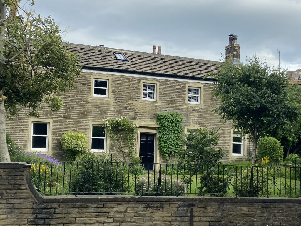
THE POPLARS, RASTRICK COMMON
Returning back across the road, the second house along from the bottom of Bowling Alley is a house named THE POPLARS. It is a wonderful example of a Georgian house but the oldest part was was a farm in the reign of Queen Anne (1702-14). The later additions were added by Dr. Joseph Fryer (1755-1816), a surgeon and apothecary after he acquired the house from his father upon his marriage to Amelia Dyson in 1780. We have mentioned the Fryer family several times already in connection with some of the main houses in Rastrick, namely Castle Hill House, Rastrick House and Holly Bank House. Joseph Fryer’s father was also called Joseph (1701-1787). He was a Quaker and had used some of his wealth from his stuff making business to purchase The Poplars and had added to his existing estate in 1773 by buying twenty-six acres of land on either side of Rastrick Common. This land included Rosemary Park, the Scholey’s and Bowling Green Bank. I suspect that the sale of this same land in 1847 came about following the death of Joseph Jowett Fryer in 1846.
It seems that The Poplars became the official residence of several other Rastrick surgeons after Dr. Joseph Fryer vacated the premises. Dr. Tempest Pollard lived there from the 1840’s until 1861 after which Dr. Henry Pritchett moved in until the 1870’s. He was born in York in 1832 and was the surgeon who gave evidence at the trial of Mary Ann Dyson in 1864 as to how her murdered children at Stackgarth had met their untimely deaths.
The last medical practitioner to live there was Dr. Stuart who left in the mid 1960s and retired to the Lake District where he died aged 99 in February 2002.
RASTRICK’S ANCIENT COMMON FIELDS
Rastrick had a four field system which stretched from Round Hill to the former brickworks off Gooder Lane, east to Toothill and Woodhouse, and west to Lillands and Boothroyd. The name of Rastrick Common or Common as it appears in early census records, derives from the fact that it was the road which travelled through the Common Fields of Rastrick. From the early 1400’s, families such as the Fryers and Thornhills acquired most of the agricultural land in this area, making money by leasing the farming rights to tenants.
So what was the four field system? It was original introduced in this country by Viscount Townshend (1674-1738) and was a successful method of crop rotation. The land was divided into four main field areas where four different types of produce were grown in rotation. In year one, wheat, essential for making the bread that fed the residents was grown in the first field. In year two, the wheat was grown in another field and the former wheat field was used for growing clover or ryegrass. This was then used to graze the cattle which provided milk and meat. In year three, oats or barley was grown, providing more food along with a key ingredient for brewing ale. In year four, turnips or swedes were grown, providing winter vegetables for both the residents and the cattle.
By adopting this system, Viscount Townhend found that he could grow more crops and get a better yield from the land. Without rotating the crops, the nutrient levels in the soil decreased annually which had an adverse effect on the crop quality and yield. In earlier agricultural systems a field had to be left fallow or resting every third year but the four field system meant every field could be used year after year, in fact, the land could be improved by this method. Cattle grazing in the clover and turnip fields helped to replace the nutrients in readiness for growing wheat, oats and barley in the following years. Any system that produced more food was deemed to be a success.
The urban expansion from the 1820’s has eliminated much of the agriculture in mid and lower Rastrick.
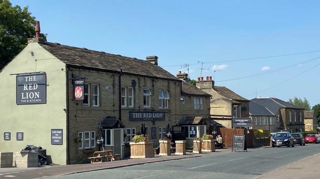
THE GLOBE INN / RED LION, RASTRICK COMMON
The Red Lion public house on Rastrick Common actually started life under that same name but most people remember it as The Globe, a name under which it traded for around 140 years until 2019. It was originally three separate houses but the original cottage gradually expanded over time. As a single cottage, the licensee often had to had have another job to supplement their meagre income from selling ale and in 1851, John Whitehead its shown in the census as a woollen carder and publican whilst in 1871, Joah Pearson is shown as an inn-keeper and shoe-maker at the premises.
Whenever there has been misfortune of this nature at a public house, it seems that the building suddenly becomes the subject of strange ghostly goings on. The Red Lion is another such case and the restless soul of former landlord, Albert Marshall, who hung himself in a washroom at the rear of the pub in 1910, is supposed to haunt the Red Lion.
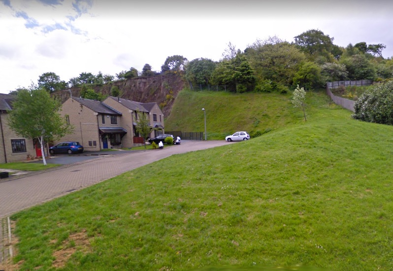
RASTRICK COMMON SCHOOL
The above photograph is of the end of Sugden Close, part of the School Green estate where Rastrick Common School used to be located.
The school was established by private subscription in 1836 as the Brighouse & Rastrick British School. The majority of the subscription came from the Quaker Society whose schools worked on what was known as the monitorial system. This was a cheap way of bringing education to the working classes as it involved a very few teachers. The idea was that the teachers educated the children up to a certain age at which point the older, more clever pupils became monitors who passed on their knowledge to younger children.
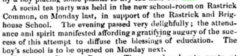
In the Bradford Observer dated 2nd November 1837 (above), there is a report about a social tea party being held in the new school room in support of the Rastrick and Brighouse School at Rastrick Common where ‘the boys school is to be opened on Monday next. The new school room was also used for other events such as the first Brighouse & Rastrick Horticultural Society meeting in September 1839.
Dr. William Lundy (1816-1860) was the first headmaster and when he left around 1853 to take over the private Larkhill Academy at Brighouse, he was succeeded by Thomas Metcalfe.
The school continued to grow as both infant and junior classes were added and a girls school was opened. It appears that the quality of instruction diminished as in December 1871, the Huddersfield Chronicle reported that ‘the British Infant School at Rastrick was inspected and deemed unsatisfactory because the infant children are too numerous.’ Thomas Metcalfe made the decision that no children under six years old would be admitted when the new term started in January 1872. The school was constantly struggling with its finances and two years later, Metcalfe had had enough. The same newspaper reported in December 1873 that ‘there was much regret in Rastrick after Thomas Metcalfe resigned as the headmaster of the British School after many years, to take up a more lucrative position with the Huddersfield School Board.’ There was much sympathy for Metcalfe, especially after his sister, with whom he lived, fell down the cellar steps and died in September 1870.
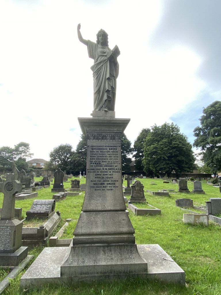
By 1881, the Quaker Society were struggling to provide the necessary finance to run the schools. The buildings were inadequate and after alterations to the law on education, the managers of the Brighouse & Rastrick British Schools and the New Road British School at New Road Sunday School, Rastrick declined to continue running the schools and insisted that the local authority, the Rastrick Local Board, formed a School Board to take over the management of the schools. This was agreed in July that year whereupon seven influential men formed the new Rastrick School Board. The men were Mr. A. T. Clay of Holly Bank, Hanson Ormerod jnr. of Boothroyd, John Taylor of Clough House, John Thornton of Yew Cottage, J. G. Wilson of Ivy House, Rhodes Sowden of Royd House and Wm. Smith of Lands House. The schools from then on became known as Rastrick Board Schools.
A report in 1883 stated that three hundred and eighty-two boys were being taught at Rastrick Common in just three rooms. The girls were located at other premises in Gooder Lane. As a result of the overcrowding, plans for much needed extensions to the school were drawn up and the work was soon completed.
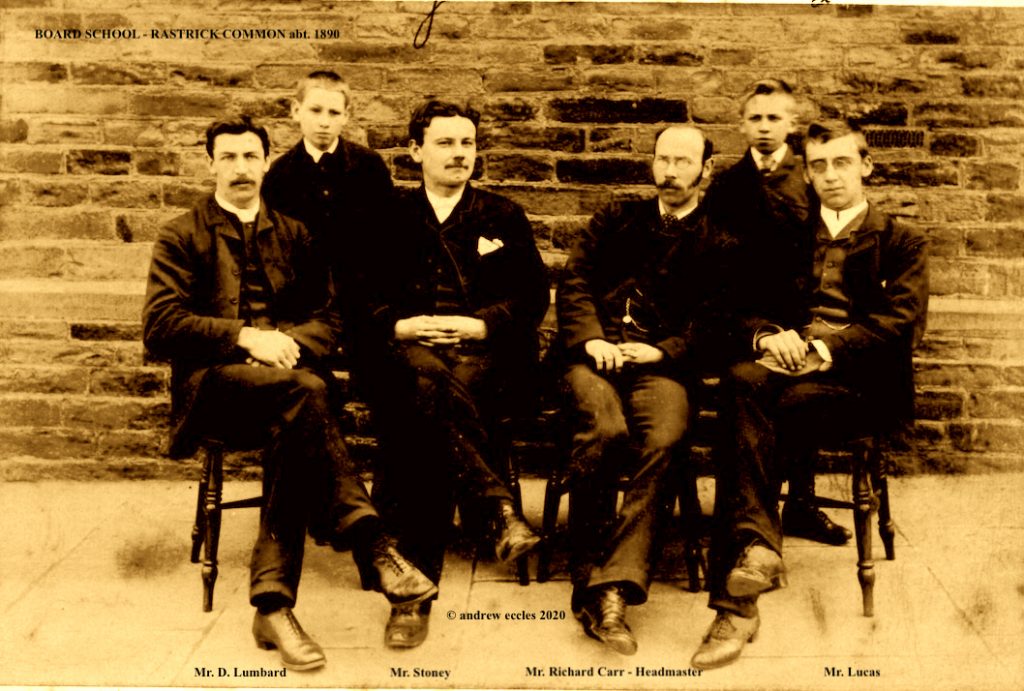
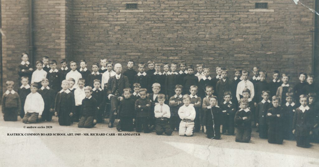
Above, I have shown two very old photographs in relation to Rastrick Common School. The top picture was discovered in 1972 by the son of the teacher on the left, Mr. D. Lumbard. His father had thankfully named all the other teachers along with the location where it was taken, making it an early important photograph of education in Victorian Rastrick. The second photograph dates from about 1910 but both pictures show the headmaster of over 30 years, Mr. Richard Carr. He was born in Ecclesfield, Sheffield in 1855 and took over as headmaster at the Board School around 1887. He lived at Nunnery Lane, Rastrick when he first arrived in the area, moving to Aire Street, Gooder Lane and finally 104 Rastrick Common, very close to his school.
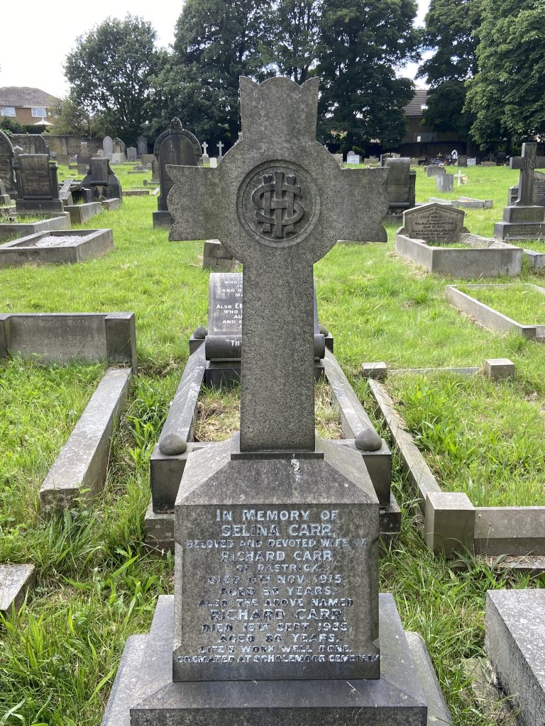
His wife Selina passed away in 1915 and was buried at Carr Green Cemetery, Rastrick. Richard retired in 1921 and went to live near Morecambe where he died in 1935 aged 80 years. After being cremated, his name was inscribed upon his wife’s headstone at Rastrick with a very schoolmaster worded epitaph – LIFE’S WORK WELL DONE.
In 1933 and 1938, further classrooms, cloakrooms, indoor sanitation for boys and girls and a staff room were added as the school re-organised to become a Senior Mixed School. The year after the Education Act of 1944, the name was changed to Rastrick Common Secondary Modern School at which point the school leaving age was increased to fifteen years. In order to accommodate the extra pupils, a HORSA classroom was added. This was an acronym for the ‘Hutting Operation for the Raising of the School-Leaving Age’ and was devised by the government not only to house the extra pupils but also to replace school buildings that had been damaged during the war. They came in flat-packs and were constructed of concrete and wood with a corrugated asbestos roof and were designed to last around ten years but many were still being thirty years later. The headmaster throughout these changes was Mr G.H. Parr who remained in post from 1921 to 1954.
In 1976 the pupils moved to a new building at Reins Wood (now Rastrick High School) and the Rastrick Common site was handed over to Halifax Technical College as a satellite site for craft training. That role ended around 1995 after which the buildings were demolished and the site was cleared for a modern housing development.
As mentioned at the start of this section, two of the road names in the development are School Green and Sugden Close. The third name is Hions Close, named after the former Labour Councillor and later the Lady Mayoress of Brighouse, Emma Hions. Emma was awarded the MBE for services to local government and the community in 2001. Although the Hions name originates in London, it goes back many years in Rastrick as her husband Stanley’s grandfather was the groom at Rastrick House and in the 1880’s lived in the lodge on Field Lane which we visited earlier in the tour.
IVY HOUSE
Just down Rastrick Common from the Red Lion public house is Ivy House. Built as a commodious family home in the late 1850’s, Ivy House became the residence of Joshua Garside Wilson, the owner of the nearby Rosemary Mill, which we will visit shortly. Wilson died there in 1898 and is buried at St. Matthew’s Church. In the 1980’s, the house was extended and converted into a residential home for the elderly. It is now known as Cygnet Lodge, a high dependency rehabilitation service, owned by the Cygnet Health Care group. We then travel down the Common a few metres and turn left into:
ROSEMARY LANE
The road surface is still constructed of old stone setts, horrendously slippery in icy weather as I once found out whilst being driven down here as a helpless front seat passenger. This road leads down to where at least three different Rosemary Mills have stood but the area is now a residential housing estate.
This area was known as Rosemary Park and here, we once again encounter the Fryer family as Rastrick land-owners. In 1773, Sir John Lister-Kaye sold the land to Dr. Joseph Fryer. There was a further land sale in 1802 where there is mention of a newly erected water mill, steam engine and dye-house.
In 1829, Dr. Fryer’s two eldest sons, Joseph and William are shown as merchants, bombazine manufacturers and manufacturers of fancy goods in Pigot’s Directory of 1829. Bombazine was a silk and wool fabric which was highly fashionable in ladies clothing whilst the fancy goods refers to flamboyant waistcoats worn by gentlemen of that time. This suggests that Joseph & William Fryer were manufacturing textiles at Rosemary Mill in 1829 and probably several years prior to that date.
Joseph and William Fryer’s partnership was dissolved in 1836 as William spent more time in London and the business was handed to two of Joseph’s sons, Charles and Joseph Jowett Fryer but the latter named son and his father both died in 1846 at which point the family decided to off-load the land and property.
The Leeds Mercury dated 8th May 1847 carried an advert for the sale of the land. The sale was held on the 17th May 1847 at the Thornhill Arms, Rastrick. Amongst the several lots, Lot 11 was described as a substantial stone built three storey mill called Rosemary Mill measuring 60ft x 40ft. It comprised of the ‘mill, engine house, shafting, 12 horse boiler, joiners shop, cottage, outbuildings, stone bridge and approach, dam, weir, goit and a close of land called Rosemary Park in the occupation of J.J. & C Fryer’
Lot 12 was ‘all that garden with the bath, adjoining Lot 11 in the occupation of J.J. & C. Fryer containing 810 superficial square yards, more or less’
The ‘bath’ referred to in the advert was actually the public baths where, in the days when most houses didn’t have a bathroom, workers could go and have a good wash. They consisted of outdoor stone troughs which were purchased through public subscription in 1758. The baths were fed by the stream that we mentioned earlier, which springs at Lower Cote, Fixby and travels down the valley through Carr Green. I would imagine they were very cold in the winter months.
It would appear that the purchaser was Joshua Garside Wilson who we met a short time ago at Ivy House. In 1851 he was living with his sister and her husband, John Craven at Brookrennels, an old name for this area of Rastrick. Both men are shown as woollen fancy manufacturers in the census records and Wilson was running his company, J. Wilson & Co. from Rosemary Mills. The first mention of his ownership is in the 1857 electoral rolls where he is shown as owning not only Rosemary Mill but also the Oddfellows Hall in Brighouse.
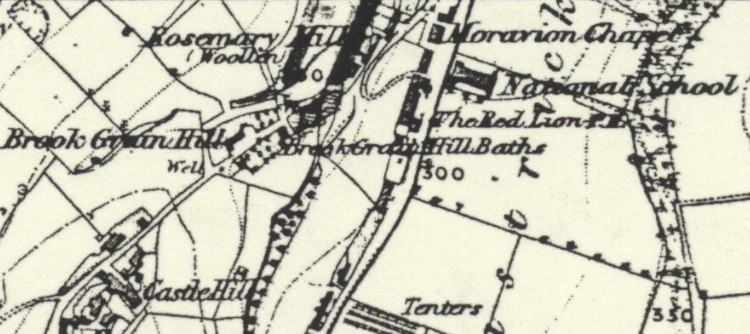
The above map from 1854 shows Rastrick Common which is the road down the centre. The Red Lion public house and the National School are marked as are the Brook Grain Hill Baths and Rosemary Mill but the relatively small three storey mill was proving to be too small for Wilson’s expanding business and new premises were needed.
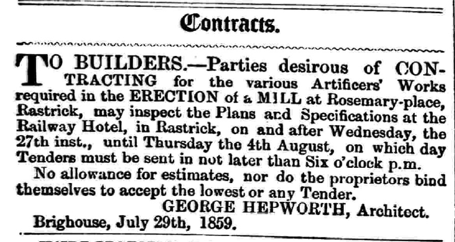
In 1859, George Hepworth, a local Brighouse architect received instructions from Joshua Garside Wilson to design a new mill at Rosemary which would meet the needs of his growing business. An advertisement was placed in the Huddersfield Chronicle on the 30th July where builders were invited to tender for the work of erecting the new building.
The old mill was torn down and a new Rosemary Mill replaced it. The stream that powered the old water mill and fed the public baths was utilised to fill a new mill dam which ensured there was sufficient water for the modern new steam boiler which powered the machinery. Joshua Wilson’s brother-in-law, John Craven was a partner in the business as he is recorded as residing at Ivy House in 1861 and an employer of 30 men, 28 women and 12 boys. A later newspaper report about a fire at the mill in 1868 names it as Messrs. Craven & Wilson, manufacturers. Craven retired in 1870 and went to live in Brighouse at which point Wilson moved into Ivy House to be closer to his business premises.
Wilson resided there until his death in 1898 after which the mill was occupied by Armitage Silk Spinners who eventually sold out to Walshaw Drake, a company that had started by renting a disused weaving shed at Rosemary Mill in 1903.
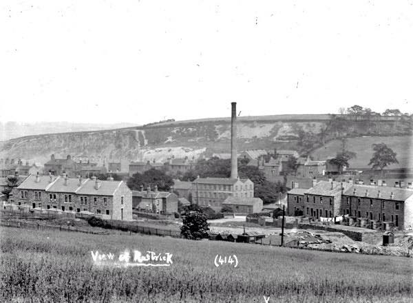

The above photograph on the left is taken from the area which is now the top of Castlefields Crescent near to Field Top Road. The houses on the left are Castle Terrace, a cul-de-sac off Castle Avenue, the latter not being built until 1938. The houses to the right are on Castlefields Drive with Rosemary Mill in the centre and the cliffs below Healy Wood behind. The photo to the right is taken from Rosemary Lane looking in the direction of Lillands.
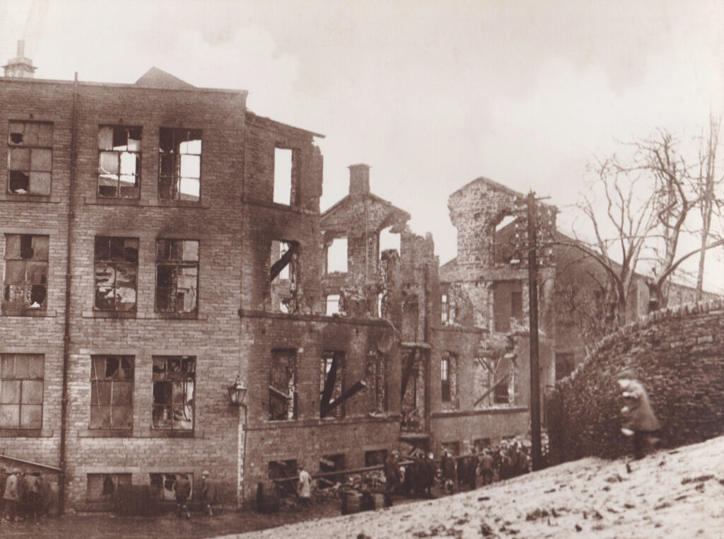
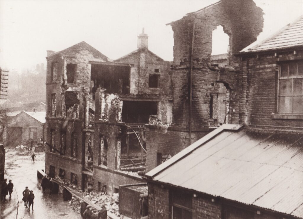
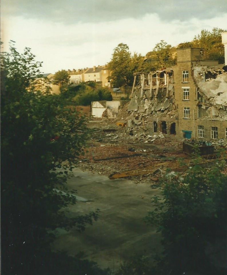
Walshaw Drake’s prospered as slubbing dyers but were hit by a huge fire on the 31st January 1923 when the above mill was destroyed. The two photographs below, kindly donated by Dave Lister, show the extent of the damage after the fire.
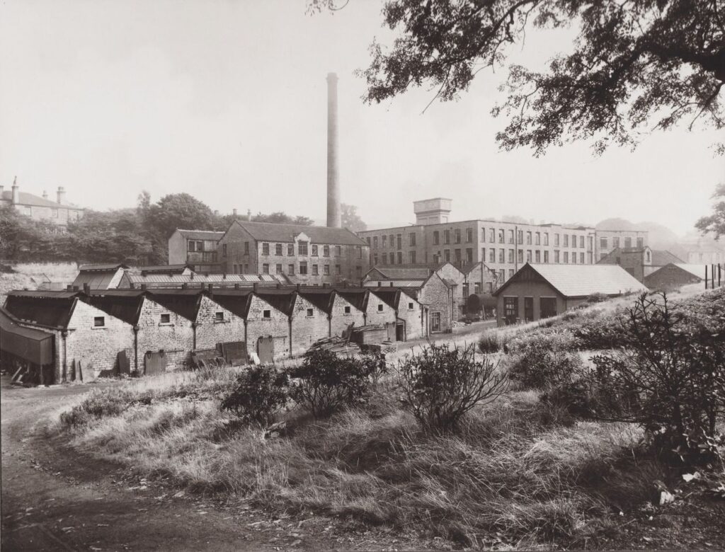
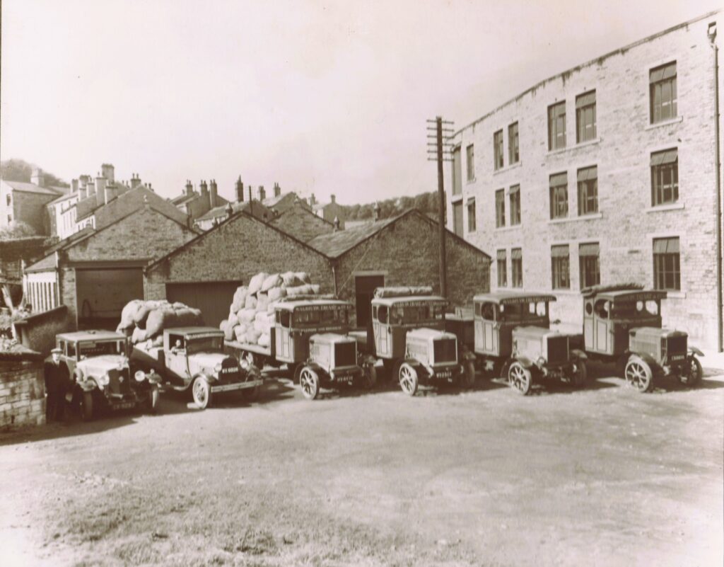
The firm managed to survive the disaster and a third mill was erected on the site. The three photographs below were also kindly donated by Dave Lister and show the replacement buildings in 1932 and the motor wagons that brought raw materials to the mill and delivered the finished products to their customers.

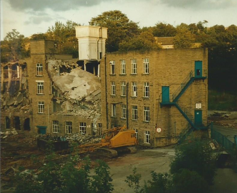
Walshaw Drake became part of the Bulmer & Lumb Group in the mid to late 1950’s when the owner, Lloyd Walshaw was nearing retirement and sold out to company that had previously been a customer. Bulmer & Lumb later became part of the Allied Textile Company and most of the group business was transferred to the Bulmer & Lumb site at Buttershaw, Bradford. This signalled the death knell for the Rosemary Works and they were subsequently demolished after just over seventy years of use. The demolition was captured in the below photographs donated by Geoff English and houses were built on the site in 1997. Thus ended almost two hundred years of textile manufacturing on the site of the former Rosemary Park, Rastrick, a name that is almost lost in the mists of time.
At the bottom of Rosemary Lane, the road name changes to Brook Grain Hill. This ancient name comes from grein, an old Norse word meaning a junction or a place where two watercourses meet. There are two streams that meet near here, the first being the one we have just mentioned that helped to power the original water mill whilst a second stream rises from the ground in the fields at Moor Hey between Pinfold Lane and Ainley Top. This stream filled the dam at John Smith’s Mill near to the Sun Inn and then travelled under Badger Hill cricket field where it then filled the dam at Spout Mills. It continued its journey on the land between Tofts Grove and Crowtrees Lane, filling a third mill dam at Crowtrees Mill before going back underground beneath The Orchards, Castlefields Drive and Thornhill Road, where it joins the other stream near Brook Grain Hill. The two streams then flow under Bramston Street recreation ground to Bridge End where they empty into the Calder behind the railway arches at Rastrick bridge.
Near to the top of Brook Grain Hill is another entrance to the Golf Club and Castlefields House.
CASTLEFIELDS GOLF CLUB
Castlefields Golf Club was formed at a meeting in March 1903 held at the Rastrick Constitutional Club. The members rented this land from Arthur Travis Clay for £7 per annum and created a six-hole course. The golf course forms the majority of the former Castle Hill estate which had been bought by Clay in 1882 and in the original agreement it was stipulated that should the club ever fold, they would only ever be allowed to sub-let the land for grazing sheep and no building development could take place upon it.
The club was in danger of closing during the 1st WW as many members were called away upon active service and at the 1918 annual general meeting, only four people were present. Things gradually improved after the war and by 1924, the membership had risen to forty-eight and by the end of the 2nd WW, to seventy-five.
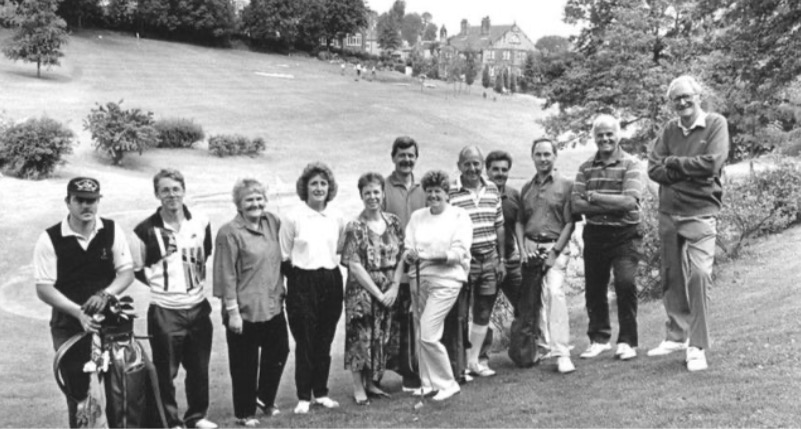
In 1960, the club bought the land for £250 from the Clay family and despite it being one of the smallest golf courses in the country, the club continues to thrive. People like Peter Thompson, who as a member of the club for several decades and a former green-keeper, has dedicated much of life to the success of Castlefields. As a former employee at Walshaw Drakes, he would use his breaks at work to pop into the grounds and cut a couple of greens.
The above photograph shows some of the members of the club in 1992. The club celebrated its centenary in 2003 and brought out an interesting book about the history of the golf club.
CASTLEFIELDS HOUSE
The house dates from 1882-83 and was built by Arthur Travis Clay who at the time owned Castle Hill House and Rosemary Park. Clay had bought the land and properties in 1882 following the death of the previous owner, Brighouse solicitor, Fairless Barber. A small section of the estate in a triangle of land at the top of Brook Grain Hill was known locally as Sparrow Park, an area where local mothers could meet and let their children run around in safety. The park was rented by Brighouse Council from the Clay’s but following a dispute between the two parties in 1912, it was closed and the house you see today was built on the land.
Up to the late 1990’s it was the home of Malcolm Foster and his wife Helena. Malcolm was the company secretary and director of Mellor’s Mint in Brighouse and Helena had been national President of Women’s Royal Voluntary Service. The mint company started life as mustard manufacturers and experimented with mint, a product which could only be bought fresh for a limited period throughout the year, the remainder of the time the housewife had to use dried mint. Mellor’s came up with idea of preserving the fresh mint in vinegar, a simple but extremely profitable idea. Consumers loved it and at it’s height, the company was processing 20 tons of mint in one shift. Mellor’s was eventually bought out by the famous Coleman’s of Norwich.
I have an old acquaintance who is now in his nineties and has lived at Park Royd which is adjoined to Castlefields House and divided into apartments. You couldn’t wish for more idyllic views from your living room than what these houses have, looking over the golf course.
From this location, the walk heads down Thornhill Road and at the junction with Bramston Street we bear left and continue along Thornhill Road. For researchers who are tracing their family history, you may come across an old relative in Rastrick living at New North Road and wondered, ‘where on earth was that.’ Well that was the early name for Thornhill Road on the census records. A short distance along from the Bramston Street junction you will, if you look closely to your left, see the almshouses at the top of some steps.
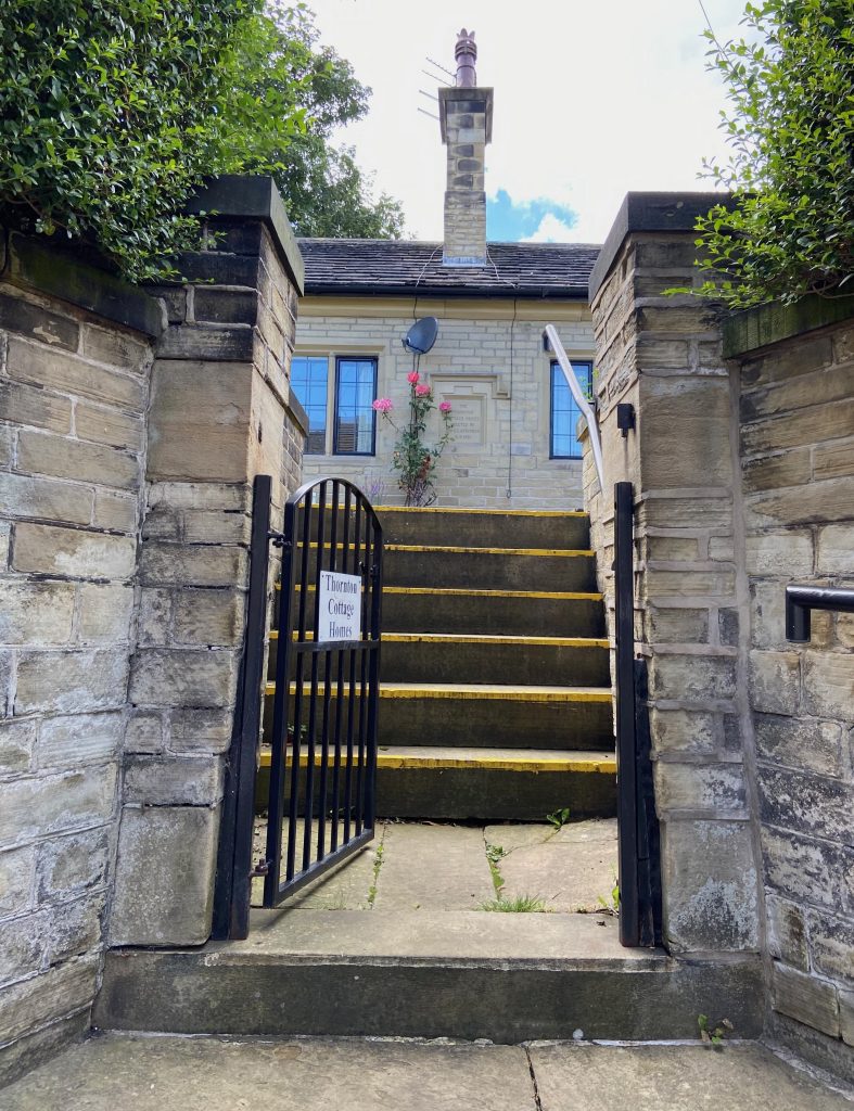
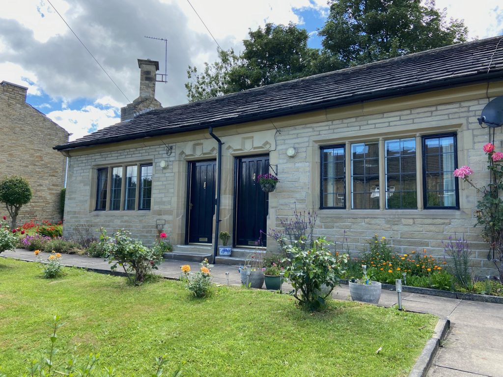
THORNTON COTTAGE HOMES
Named after Robert Thornton who was born at Nunnery, Rastrick in 1836. He co-owned a woollen and cotton manufacturing business with his cousin at Grove Mills, Elland and was involved in local politics in Brighouse, serving on various committees. He was elected Mayor of Brighouse in 1909, a position he held for seven years making him the longest ever serving mayor of the town in 81 year history of Brighouse Borough. Amongst the several buildings he officially opened during his time as mayor was the swimming baths on Mill Royd Street in 1913.
Thornton paid for the provision of a public clock and balustrade on the Town Hall in 1914 which became know at the time as ‘Owd Bob’ and following the demolition of Holroyd Buildings opposite the Town Hall, the newly formed space was named Thornton Square in recognition of his services to Brighouse. He was made a Freeman of the town in 1916 and when he finally stood down from office that same year time, he was the oldest mayor in England, aged 79 years. He died in 1918 and was buried at Carr Green Cemetery, Rastrick.
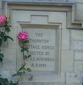
In 1921, the Four Cottage Homes or almshouses were built in Robert Thornton’s memory by his niece Sarah Edith Atkinson, who had been his Mayoress for his entire time in office as his wife had died in 1899. The cottages were renovated and extended in 2004.
THE THORNHILL FAMILY & THORNHILL ROAD
The Thornhill family were a very successful family, acquiring a great deal of land and property in Rastrick. Originally from Dewsbury, a branch moved to Fixby in the mid 1300’s and lived at Fixby Hall until 1802. In 1411 they’d bought twenty acres in Rastrick, added more in the mid 1500’s and continued to expand thereafter. From 1685 to 1809 they owned Rastrick Hall, built on land where Holly Bank House is now located. They also owned lands at Toothill for many years. When Thomas Thornhill (1780-1844) died, he was survived by three daughters, Clara, Honoria and Eleanor. These names may be familiar to some of you as street names off Bradford Road, Fartown. There is also a Clara and Eleanor Street in Rastrick but more on street names very shortly.
Following the death of her father, Clara (1836-1865), the eldest daughter, inherited the estate at the age of 8 years old. As there were no sons to continue the name, her grandfather had stipulated in his will that any future heir would have to carry the Thornhill name so when Clara married William Capel Clarke in 1855, he changed his surname to Clarke-Thornhill by Royal Licence and that family became the owners of what is now known as Thornhill Estates Limited. The Clarke-Thornhill’s developed further assets by building houses in the Huddersfield and Rastrick areas, something that is still going on to this day as more and more of Rastrick’s green fields are turned into housing developments.
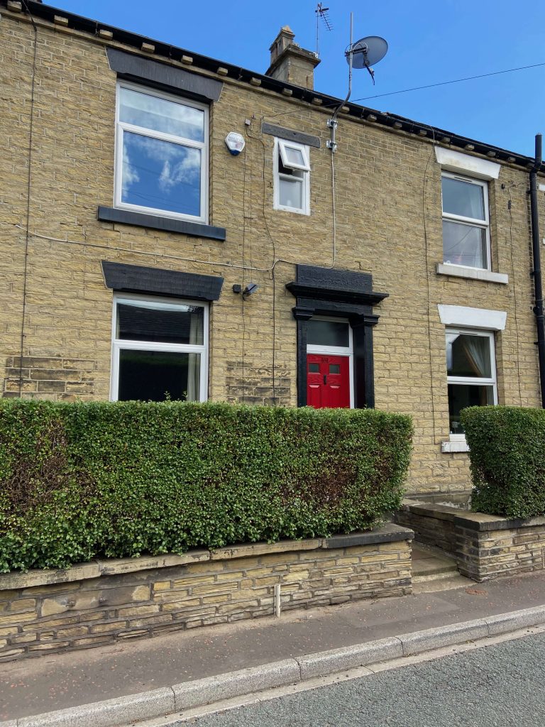
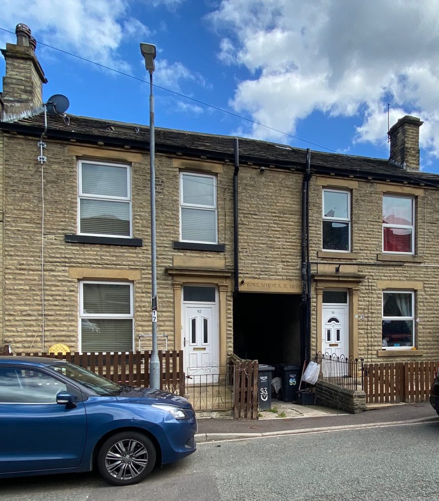
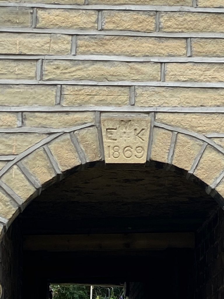
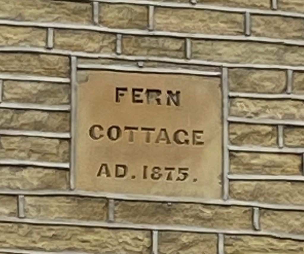
The construction of Thornhill Road was started in the mid 1860’s and several dates between 1867 and 1894 can be seen carved into the stonework on some of the houses. Many were initially built as back-to backs but a large number have been knocked through and two houses have now become one. I had relatives who lived in the back to backs and even in the early to mid 1960’s many houses didn’t have a bathroom. Men used to come home from jobs in heavy industry and bathe in a tin bath in front of the old cast iron cooking range and fireplace, surrounded by a clothes-horse draped with a large towel. The tin bath used to hang from a nail on the outside wall of many houses. It seems an eternity away from current housing standards yet wasn’t that long ago.
It is natural to assume that Thornhill Road is a long line of similarly designed terraced houses but looking closely, you will see that in many cases they are a series of two, three or four houses in a block which was then connected with the previously built block. There are several different designs of lintels above the doors and windows, some are plain whilst others are more ornately carved. From 1896 until 1998 number 85, Thornhill Road was a grocer’s shop, later becoming an off-licence. It then became a private house but it still retains the lintel over the former shop window, where a roller blind would have been attached to shield the display items from the sun. On the ground floor, most of the houses have a window to one side of the front door with two bedroom windows above but there is the occasional double fronted house with a central door and a window to either side. This suggests a difference in the status of the early occupants and shows that delvers and factory and mill workers were living alongside people in more prestigious positions.
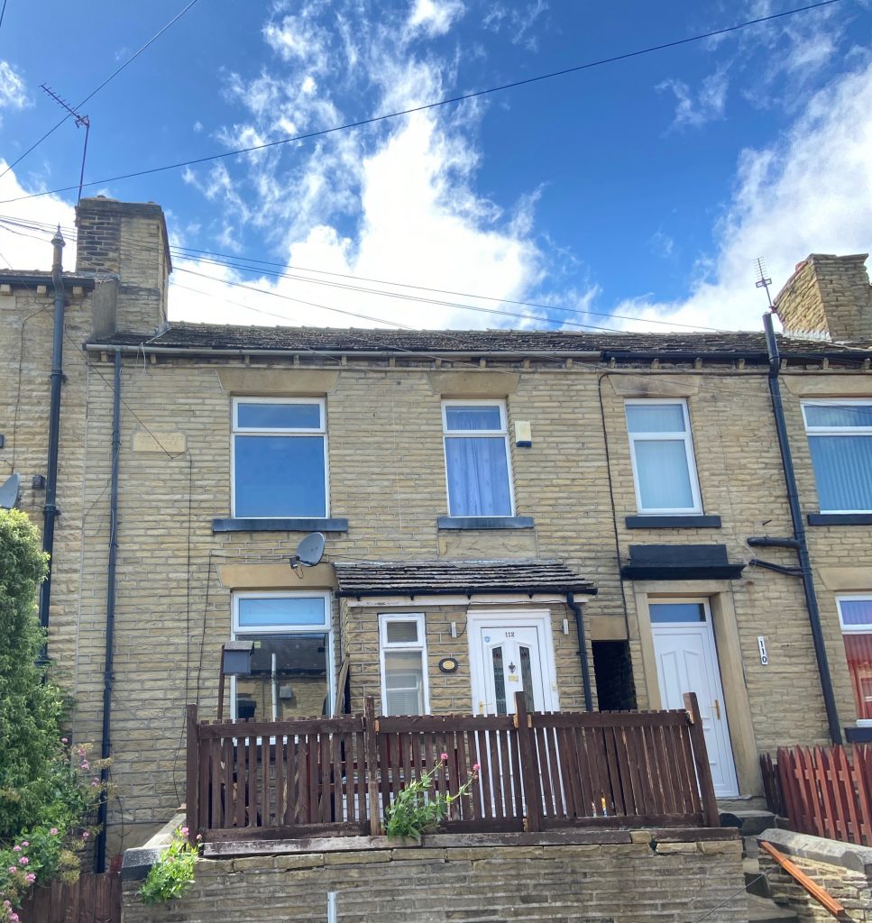
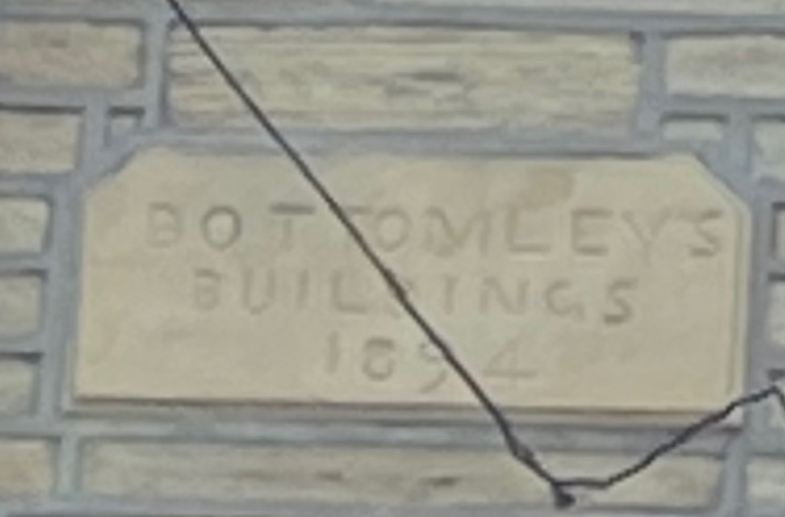
Number 112, Thornhill Road, which is located just after the turning into Ridge View Road and the Close Lea estate has a carved stone above that says BOTTOMLEY’S BUILDINGS 1894 (pictured left).
This house and the one next door at 110 were built by a local mason, Prenn Bottomley who had previously lived further along the road. These were some of the last houses to be built on Thornhill Road in a vacant plot of land. Prenn lived in their new house with his wife Hannah and six of their nine their children who were still unmarried at that time.
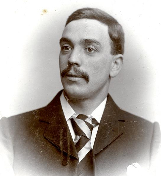
The Bottomley family seem to have had more than their fair share of tragedy over the years. In August 1883, whilst on a Sunday School trip to Scarborough, two of Prenn and Hannah’s sons, John (11) and James (15), along with a friend called William Whiteley fell 200 feet from the top of the south cliffs. The two Bottomley lads were seriously injured and taken to hospital where they eventually recovered from their ordeal. William Whiteley wasn’t so lucky and died from his injuries.
In January 1896, Prenn was found hanged in a tool shed at the rear of the house, having tragically taken his own life after worrying about his health. One of Prenn’s other sons, Frank Bottomley was serving with the Middlesex Regiment in Belgium during the 1st World War when he was wounded in battle on the 16th August 1917. He was taken to a casualty clearing station where he died six days later and was buried at Lijssenthoek Military Cemetery. Frank is remembered on the cenotaph at Rastrick Library.
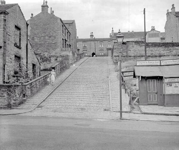
We now return to street names because travelling towards Longroyde Road there is a steep cobbled hill that leads up from Bramston Street (pictured above). The road is called Capel Street and was so named after William Capel Clarke-Thornhill, the husband of Clara Thornhill who we mentioned earlier. We also mentioned Clara’s sister, Honoria Thornhill who went on to marry Thomas Harvey Bramston after whom Bramston Street is named. Just to conclude, the ladies father and grandfather were both Thomas Thornhill (Thomas Street) whilst the great grandfather was George Thornhill (George Street).
The houses on Thornhill Road, opposite the junction with Capel Street are called Myrtle Cottage, built in 1867 with a passage running to the houses at the rear. Two outside lavatories were located at the bottom of the small garden for the houses on either side of the passageway, front and back, so two toilets were shared between four families.
A random example, using Prenn Bottomley and his family in the 1891 census shows him and his wife and six children in one house. In the second house is Frank Balmforth, a cloth warehouseman with his wife and four children, in house number three is Harry Bottomley, a stone delver along with his wife and two children and in the fourth house was Fred Smith, a delver, who lives with his wife and three children and two unmarried sisters. So sharing the two outside toilets were ten adults and fifteen children. Can you imaging living like that nowadays?
My grandmother used to call Thornhill Road the ‘New Line’. As most of the houses were built between the 1860’s and 1890’s and grandma wasn’t born until 1904, I suspect that it was a name passed on to her by her parents who would remember some of the houses being built.
Just before you turn up Longroyde Road, the large house over the high wall on the left is called Thorncliff and used to be the doctors surgery. Dr. Frederick Fielding Bond was in residence there for several years from the 1890’s. Dr. Bond handed his surgery over to a locum so that he could concentrate his efforts into helping people infected with smallpox during the 1892 outbreak in Brighouse and he spent much of that time at the isolation hospital on Thornhill Lane, Clifton, tending to the sick. He was the medical advisor for the Rastrick Local Board, founder member of the Rastrick St. John Ambulance Brigade and helped to convert what is now the William Henry Smith School at Boothroyd, Rastrick into a military hospital for soldiers wounded in the 1st World War. Dr. Bond spent the entire war years dedicating his time to nursing hundreds of wounded soldiers back to full health again. I can vaguely remember the old waiting room at Thorncliff, with its ancient gas fire and broken pots whilst waiting with my mother to see Doctors Robertson or Tong. The two doctors practiced there until they moved into the premises we visited previously off Ogden Lane around 1966. Ironically, I believe the house was taken over by a gas engineer whose name escapes me but the building is now used as a temporary ‘safe house’ for women who are in fear of domestic violence.
We then turn left up Longroyd Road
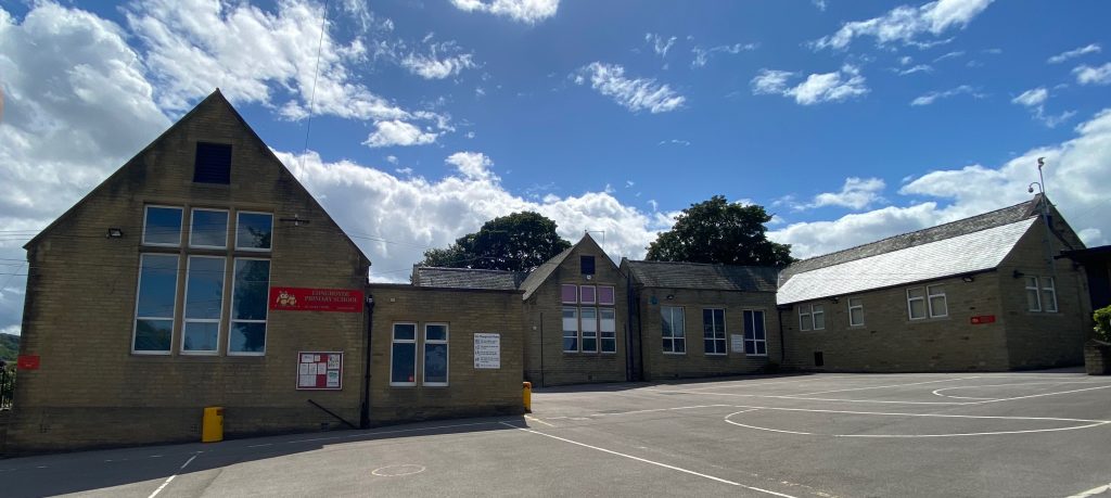
LONGROYDE JUNIOR SCHOOL
It was mentioned earlier when discussing Rastrick Common School, that in 1881 the Rastrick British Schools were under financial pressure and in danger of having to close. Rastrick Common School was an infant and junior school at this time and there were also Rastrick British Schools at New Road School on New Hey Road and St. John’s School on Gooder Lane. The Rastrick Church School was different in that it was financed by private subscription. The Rastrick School Board was formed under the chairmanship of Arthur Travis Clay and they took over the running of the British Schools. Additional classroom extensions were built at Rastrick Common but due to the great overcrowding in classrooms and unfavourable reports from the schools inspector, a new school was built at Longroyde in 1883 with additional buildings being added over the ensuing years.
Now partially obscured with overgrown bushes and trees on the roadside of Longroyde Road, this photograph shows an additional classroom at the bottom of the playground which also included the headmasters house underneath. The house later became the school caretakers home. It was built in 1896, the date being carved into a stone high above the windows.
The Rastrick School Board had some difficult decisions to make in the early years as the extra classrooms and the new school came at a cost to the ratepayers who were not happy at the increased precepts on the education rates. This led to many questions regarding the Rastrick schools because they were funded by Rastrick ratepayers yet were allowing pupils to attend from Brighouse. In September 1883 it was decided that the Rastrick schools could no longer accommodate children from north of the Calder river which meant that the new Longroyde School would be used solely by Rastrick children.
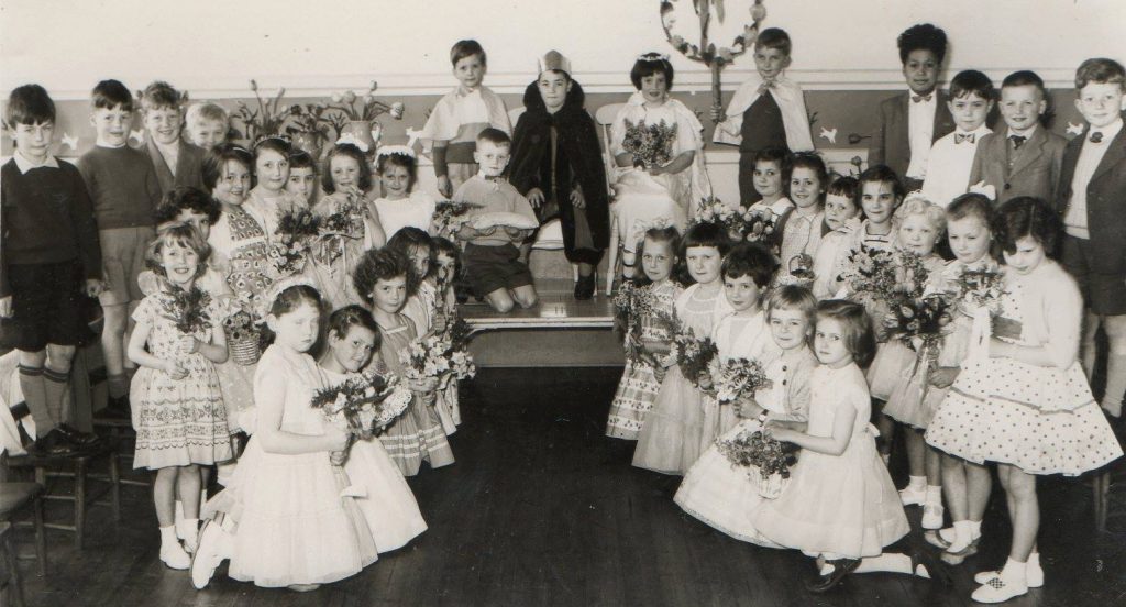
I’m sure you can all remember the May Day celebrations at our respective junior and infants schools in days gone by. Dancing around the maypole and the crowning of the May King and Queen. The above Facebook photograph was posted on the Memories of Brighouse page in 2014 by Janet Wilson and shows the May King and Queen at Longroyde School abt. 1960.
In more modern times, a Primary School was formed at Longroyde in September 2016 when Longroyde Junior School and Castlefields Infants School merged. The new school now has provision for children aged two to four years at Longroyde Nursery, housed at the old Castlefields Infants whilst the five to eleven year olds attend at Longroyde Primary, which is the former Longroyde Junior School.
STONE MINING & QUARRYING
There are many old stone quarry and delph sites all over Rastrick and the area around Longroyde and Lillands is no exception, as we touched upon at the start of this virtual walk. Thornhill Estates and other independent landowners actively developed these quarries and small fortunes were made by several families. Small quarry workings in the hillsides go back to the 1400’s, but the boom time was the 19th century following new mechanical inventions. This meant that vertical shafts could be cut through the stone and then tunnels were excavated at the bottom, spreading out at various angles, allowing vast quantities of fine quality stone to be hauled to the surface. It was a dangerous occupation with little regard to health and safety and many delvers lost their lives in Rastrick. Some died in the most appalling circumstances leaving wives and children destitute in times where a welfare state was still many years hence.
Off Lillands Lane, at the bottom of the Rastrick High School sports fields are the remains of some of the old stone mines that were worked from 1860’s to 1917. These extracted superior quality flags from selected Elland Edge beds known as the Elland Flags. They were given that name because the quality of the stone leant itself to making flag or paving stones, kerbstones, roofing slates and many other uses. Shafts of ten to sixteen feet diameter were sunk up to a depth of 100 feet. Their workings could extend 150 to 200 feet outwards from the shaft. An excellent book entitled Mining in the Elland Flags – A Forgotten Yorkshire Industry by C.G. Godwin is worthy of reading if you wish to learn more on this subject or visit http://www.stoneroof.org.uk/elland.html for a brief insight into this fascinating local industry.
LONGROYD HOUSE
At this point we are almost back to the start of this tour and so mention Longroyd House once again. In a sale notice in 1916 it was described a large detached house with outbuildings and thirty-nine acres of land. Longroyd or Long Royd House was located near to what is now the site of Longroyde Nursery School above Castlefields. It was built around 1820 and was occupied by Thomas Bradbury from around 1853. Bradbury was born in Clayton near Manchester in 1821 and was the son of John Bradbury who owned Clayton Colliery. Thomas married Sarah Holroyd from Rastrick in 1849 and settled in Rastrick, acquiring quarries at Milnsbridge and of course on his own land at Longroyde. After the Bradbury’s left, the house was bought by John Cheetham in May 1875. He owned John Cheetham & Sons silk spinners in Brighouse. In May 1885, his workers went on strike after some people had been sacked for misconduct so he closed the factory to teach them a lesson. They were all put onto the dole until he re-opened a few weeks later. He died in 1890 aged just 56 years of age.
Longroyd House opened as a military hospital on the 2nd November 1916 and closed on the 30th May 1919. The Commandant was Dr. Bogdan Edwards who also had responsibility for the hospital at Boothroyd just across the fields. The hospital was open for two years and seven months and during that time 893 patients received treatment with a total of 1,975 for the two hospitals at Longroyd and Boothroyd. They had had men from all arms of the services, including sailors. The cost of maintenance was between £3,000 and £5,000 per annum, and of that amount only £399 had been paid in salaries and wages whilst the cost of administration had been zero.
It became a farm in later years and is shown on 20th century maps as Longroyde Farm as opposed to Longroyd House on the earlier maps. The Cheetham family left in 1949 and the house fell into disrepair, eventually being demolished when the area was re-developed for housing and schools in the very early 1970’s. There is a story of one of the farm workers at Longroyde Farm on this website at:- https://myrastrick.com/frank-clegg-of-longroyde/
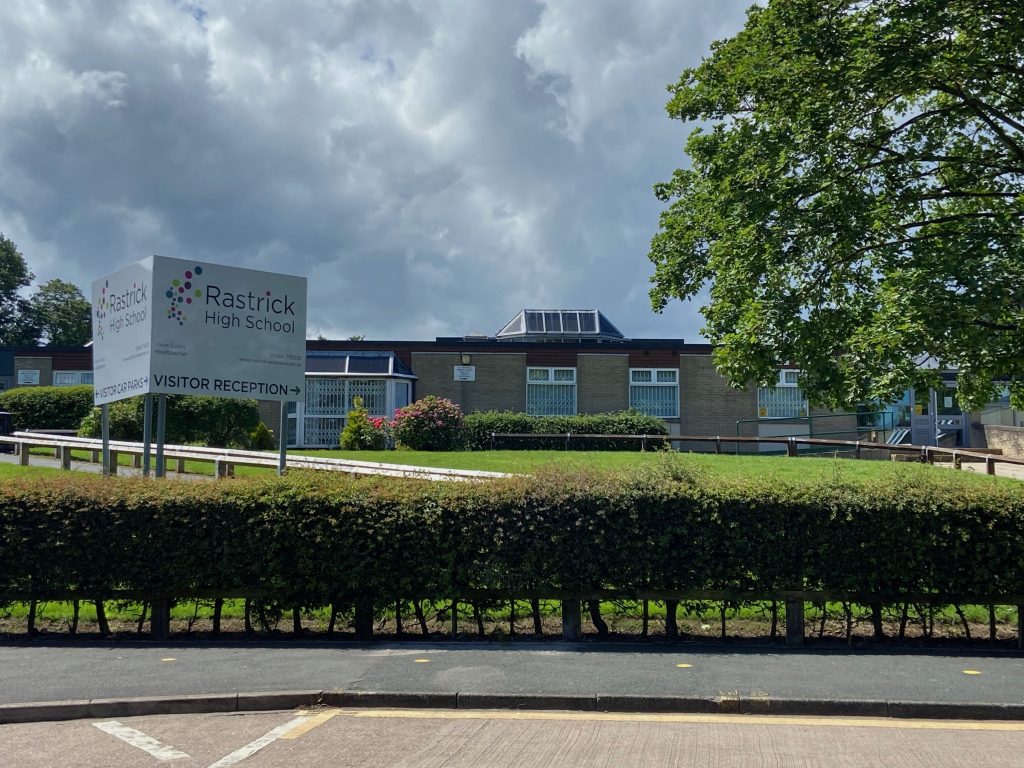
We now return to the starting point at Rastrick High School and so conclude the circular walk but as I have touched upon BOOTHROYD, I will finish by mentioning some details about the house even though it is further up the fields towards Lower Edge and we do not visit it.
A family named Boothroyd is mentioned in the court rolls in 1272 and it recurs regularly throughout the records for the next six hundred years. There appears to have been a long record of habitation on this site and the oldest parts of the present building date from the early 1800’s.
The Hoyle family were residents in the 1830’s and they were followed by Charles Pitchforth, a local stone quarry owner, merchant and social reformer. Pitchforth had acquired the property through his wife’s family, the Hanson’s, who had been large land owners in Rastrick for over three hundred years. He died in 1862 and his wife followed in 1868 which coincided with the marriage of their daughter, Eliza Ann to the Reverend Richard Judd, the first vicar of St. Mary’s Church, Halifax. The newly married couple moved into Boothroyd but when the Reverend Judd moved on in 1890, the house was purchased by Mr. Hanson Ormerod, a member of the silk spinning family from Brighouse.
After the Ormerod’s departure in 1915, Boothroyd was bought by Ald. William Smith of Lands House and owner of John Smith’s textile mill at Dewsbury Road, Rastrick. Smith was the first Mayor of Brighouse in 1893-95 and then served a second term from 1904-1907. Immediately after the purchase, he arranged for Boothroyd to be converted into a military hospital at his own expense. It was run by Dr. Bogdan Edwards in conjunction with the similar military hospital at Longroyd House.
The Smith’s didn’t have any children of their own and following the death of the wife of his cousin, the Smith’s adopted their son, William Henry Smith. He was educated accordingly and trained to take over the reins of the textile company but like many local men, he went off to serve King and Country in the 1st World War. He never made it back home after a snipers bullet ended his life in April 1917.
William Smith’s dream of an heir to his textile empire was in tatters but he was benevolent to the last and after the war had finished, he had Boothroyd converted into a ‘Smith’s Home’ for non-conformist orphans. Following his death in 1922 he left a substantial sum of money as an endowment for Boothroyd.
In 1961, the orphanage was converted to be a residential school for boys with special needs and was named after Alderman Smith’s adopted son William Henry Smith. Extensions and improvements were completed in the 1970’s and the school can take eighty-four boarders who might have particular education needs due to emotional, social, behavioural, medical or educational conditions.
Below is the grave of William Smith and his wife Susannah at Carr Green Cemetery. Note that William Henry Smith (W.H. SMITH) is included on the inscription although his actual war grave and final resting place is in France.
That concludes our virtual tour of Mid-Rastrick. I hope you have enjoyed it, found it interesting and learned something new about our history rich township of Rastrick.
Andrew Eccles © 2020