BROOKFOOT WEIR COLLAPSE

THE WEIR THAT CREATED A HEAD OF WATER TO DRIVE THE ANCIENT BROOKFOOT CORN MILL HAS BEEN SWEPT AWAY IN RECENT FLOODS

INTRODUCTION

Sunday 31st January 2021.

A water powered corn mill was recorded at Brookfoot as early as 1661 when Bridget Scolefielde was the occupier of a ‘corn milne’ at that location. The mill belonged to the Shibden Estate which had to pay £11 per annum towards the upkeep of Hipperholme Grammar School. In order to drive the giant grinding-stones, a weir was built across the full width of the River Calder. A mill race was then constructed along the Brookfoot bank of the river. The race was so called because it was slightly lower than the top of the weir and so the flow of the river was forced into a narrow gulley. This greatly increased the force of the water which ‘raced’ down the channel and powered the water wheel that in turn, powered the machinery within the mill.

The weir has been repaired many times over the centuries but has suffered from neglect in recent years and hasn’t been in good condition since the capping stones were washed away from the side nearest to the Lillands banking. Despite this, the weir was still holding back water to a depth of around 1.5 meters.

The weir at Brookfoot before the collapse

On a recent addition to this website at:- https://myrastrick.com/brookfoot/ I posted the above photograph but the recent heavy rain has taken its toll on the weir yet again. The whole of the centre of the weir has collapsed under the extreme pressure and was washed downstream. 

The above video clip taken on the 31st January 2021 and shows the breach in the weir. There is no longer any difference in the river level on either side and this has had an effect on the whole of the river going upstream towards Elland.

As a result of the drop in the water level behind the weir, the previous sand and gravel river bed is now above the water level. It is now possible to walk on the former river bed and around the bend above, which hasn’t been possible for over 350 years.

The above photograph shows the damage from the opposite side of the weir, looking down the river towards the Brookfoot bend where the river meanders around towards Brighouse. I would imagine that when the weir collapsed, a mini tidal wave would have surged downstream for quite a considerable distance as there would have been hundreds of thousands of litres backed up behind it. No-one appears to know exactly when the breach occurred so it must have been during the early hours of morning, during complete darkness. 

On this video, I walked back towards the weir around the rear of the Avocet warehouse. Had I done this a couple of days ago, I would have been wading through more than a couple of feet of flowing river.

A few more photos above which reveal the damage, the last one showing the small remaining section of the original weir overflow. I  suspect this will also disappear within the next few years if we continue to have floods on the Calder, which we have witnessed recently.

Over the years, the river has washed lots of glass and pottery remnants down the river from an old Victorian tip further upstream. The former river bed is strewn with masses of the stuff. I wonder who the last person was to eat from this ‘blue willow’ plate that dates back to around the 1850’s.

With the reduction in the water level, the remnants of the old Lillands wharf is now visible on the Rastrick bank of the river at Brookfoot. The old posts supported a wooden wharf to which stone was brought down from the quarries at Longroyd and Lillands. The posts can only be seen normally, during summer droughts. They are now several centimetres above the water level despite quite a lot of water flowing when this photograph was taken on the 31st January 2021. In summer, the river will be even lower. The posts have survived the last 160 or so years because they are submerged for 95% of the time but I think that because they are now exposed to the elements of our weather, they too will soon become a thing of the past and disappear completely.

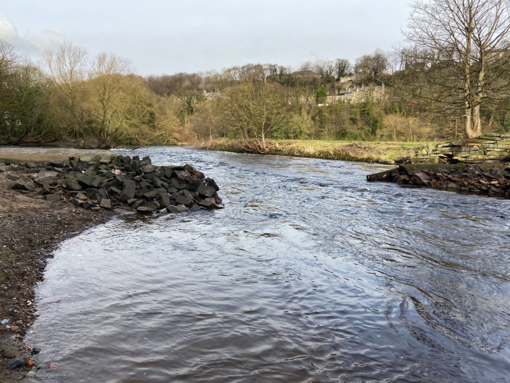
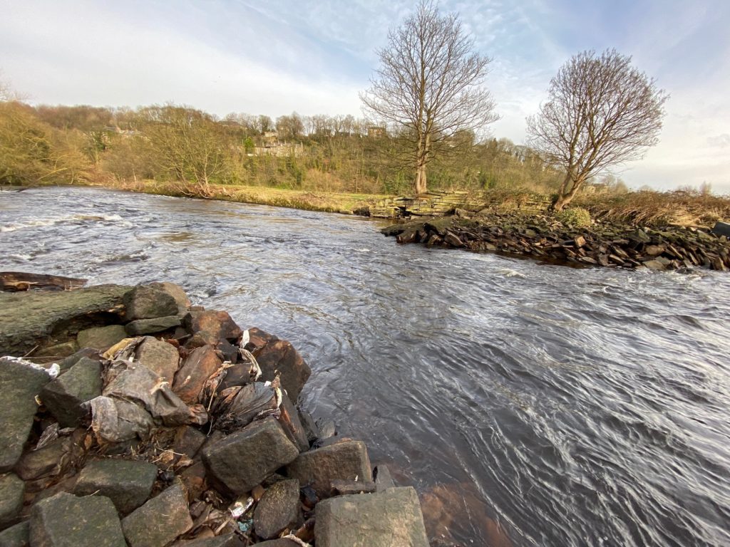
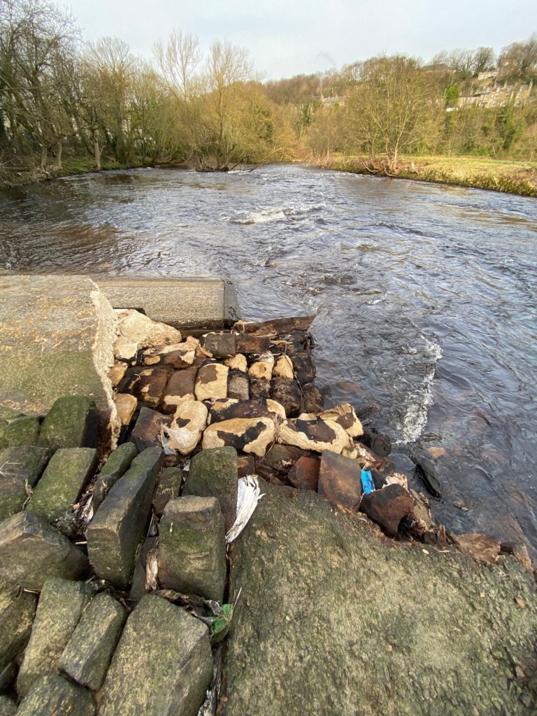
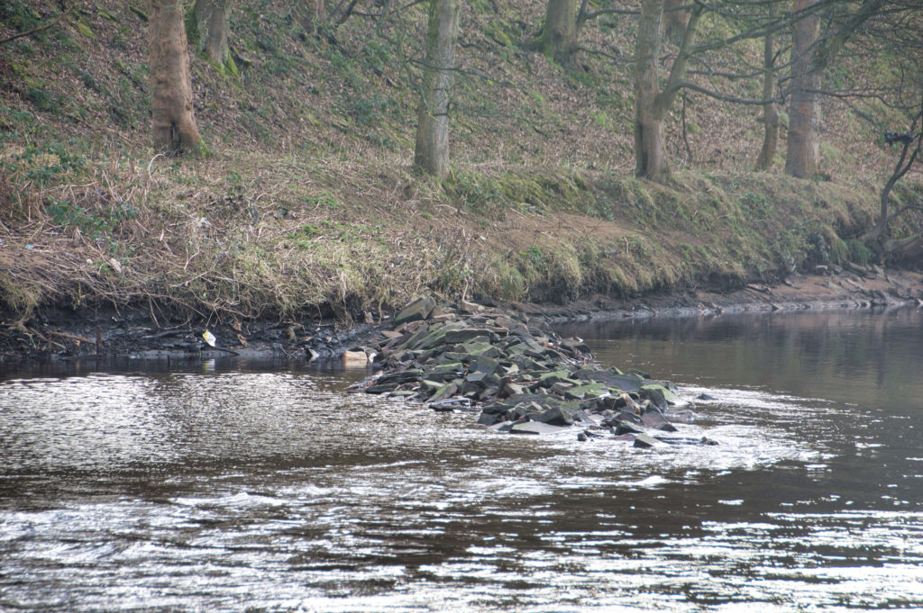
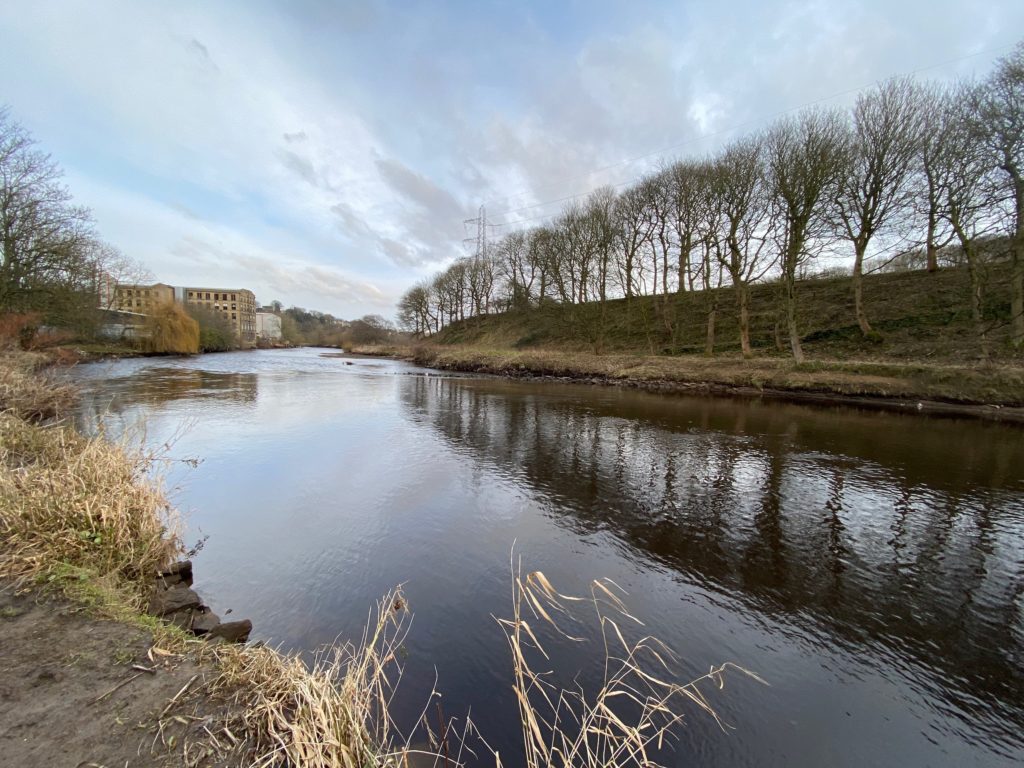
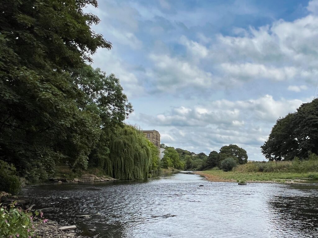
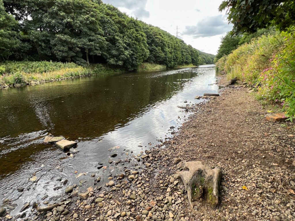
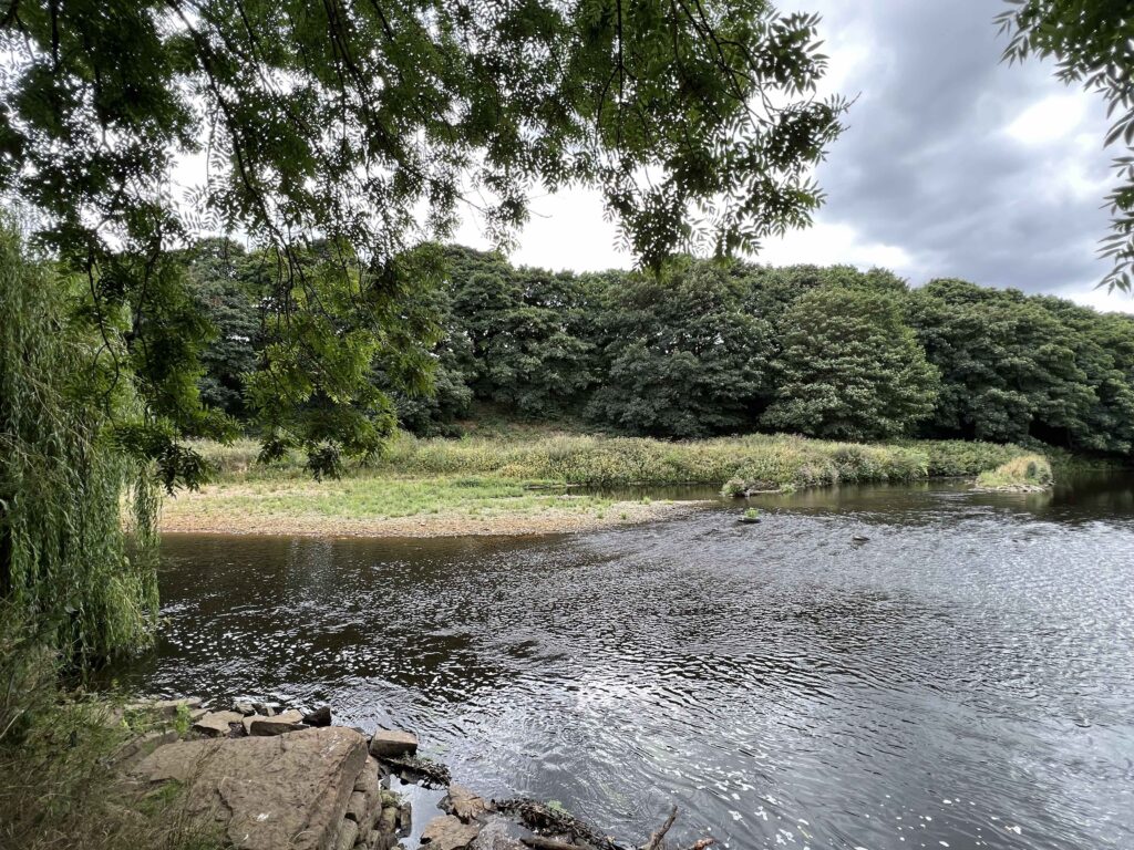
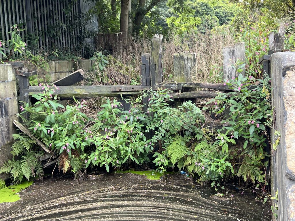
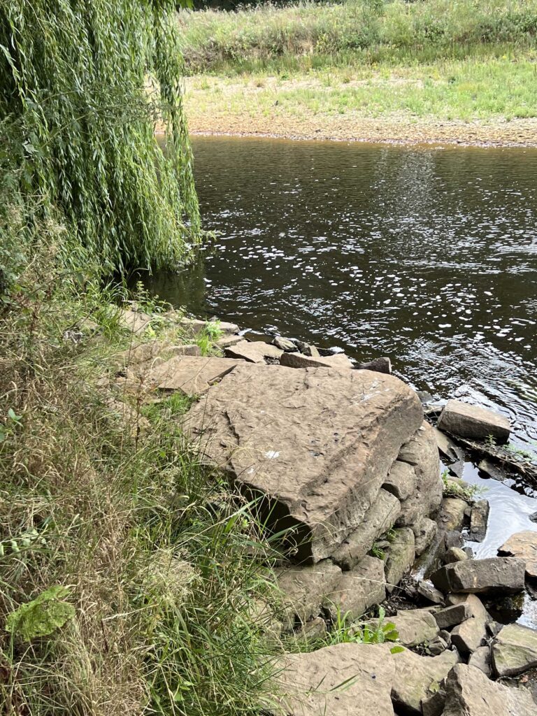
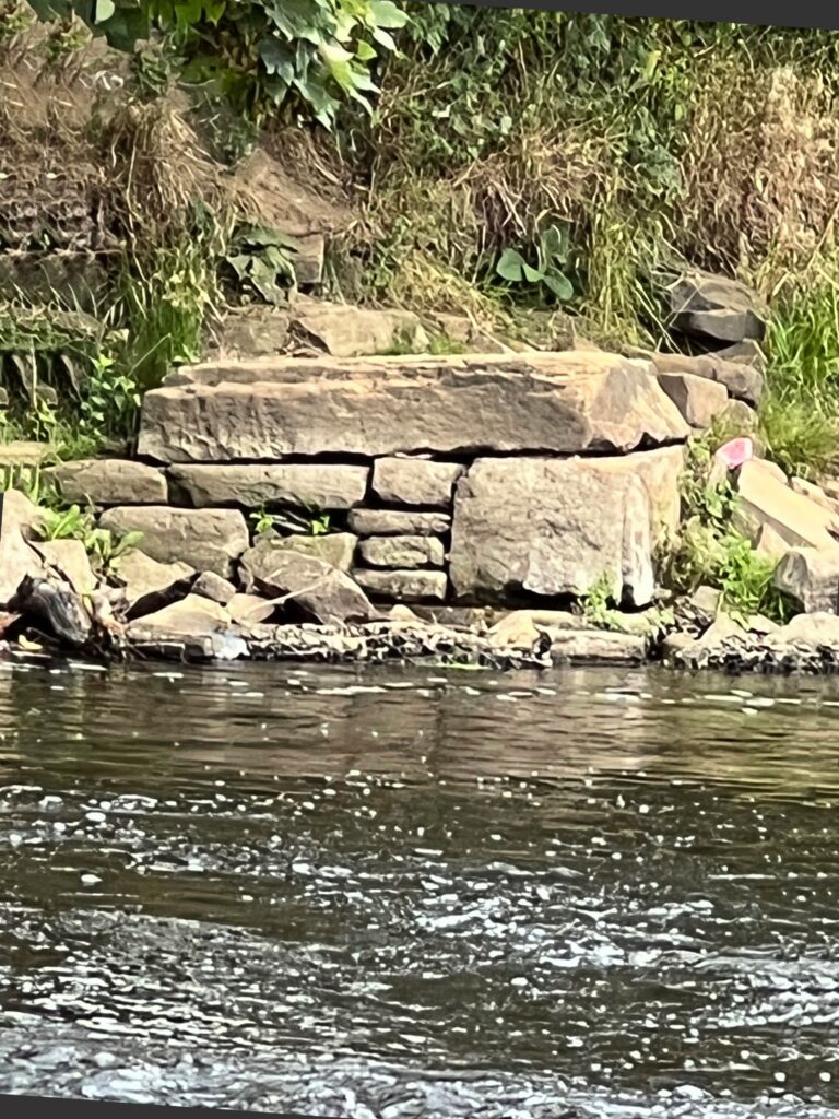
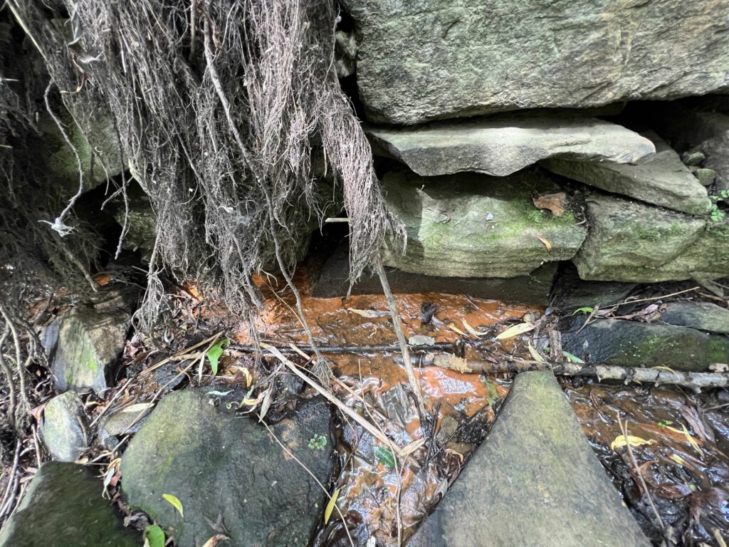
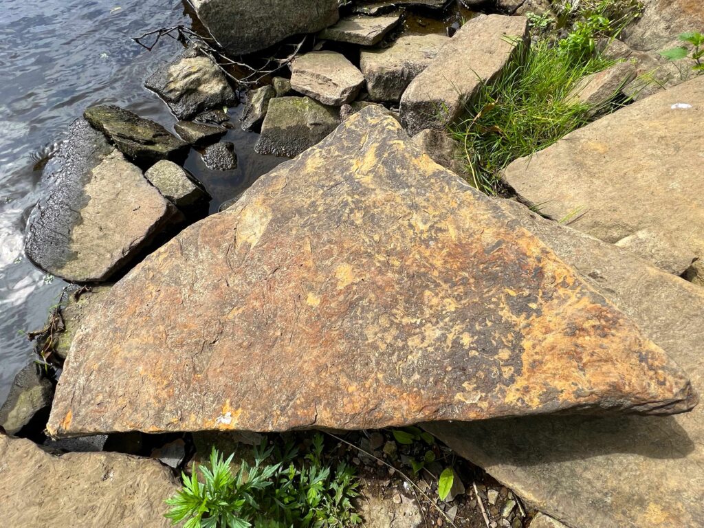
Another feature that has now appeared, which I have never seen before is this stone outcrop in the river, just above where the wharf was once located. I believe the original height of this would have been above the normal river level.  Back in Victorian times, when the Rastrick stone quarries were in full production, this stone structure would divert the flow of the water towards the centre of the river, thus protecting the wooden wharf from damage by debris that floated downstream. It also created a safe haven for barges moored at the wharf as they would be out of the main flow of the river. This would result in less pressure being put upon on the wharf’s wooden structure by the barges whilst being loaded up to their thirty-eight ton maximum weight.

Another reason for this type of jetty was that by diverting the water flow towards the centre of the river, it helped to prevent silt and other debris from accumulating on the river bed. This ensured that a channel was always clear for the barges on a navigable section of river. 

Diverting the flow away from the edges of the river also helped to prevent bank erosion so this simple method of building a rigid structure out into the river, using the abundance of waste material from the quarries, created many benefits for the navigation users. Simple but effective.

This is another view of the area where the former Lillands Wharf used to be, on the Rastrick side of the Calder at Brookfoot. You can make out the old delvers track running diagonally down the hillside in the centre of the photograph. The stone was brought down to the wharf from the quarries via this track. The former normal river level can be made out by the dark shadows in the river bank

Steel piles, which helped to prevent the river bank from being washed away are now above the water level and will only be useful in floods from now on.

With every flood, sections of banking crumble into the river making the area between the river and canal decrease with each passing year. It won’t be in our lifetime but some remedial work will have to be done one day if the two waterways are to be kept separate.

And finally to end, I love this view of Brookfoot Mill, looking downstream. It is going to be interesting in the summer if we have any protracted spells of weather without rain as much more of the river’s secrets may be revealed.

AUGUST 2022 UPDATE

Nineteen months later and we have just had one of the driest summers ever, with record temperatures in many places. On this visit to Brookfoot on the 30th August 2022, the river was very low and it would have been possible to wade from Brookfoot across to the opposite bank at Lillands, something that I have never thought likely.

Small shingle beach areas have now appeared at the side of the river which prior to the collapse of the weir in January 2021, were under about 1.5 metres of water.

Looking across towards Lillands (below), the river is considerably narrower since the water levels dropped and vegetation is now starting to grow on the previously submerged land.

Part of the old river flood lock wall that used to form the entrance to the canal is also now visible after spending 242 years below the water surface. Prior to the section of canal that we know today, between Brookfoot and Elland, being completed in 1806, barges travelling to and from Sowerby Bridge, Halifax and Elland had to enter the river at this point.

The entrance to the river was permanently blocked up around 60 years ago and the old lock gates (pictured below) were left to the ravages of time. They are gradually rotting away and have certainly deteriorated during the past five years. In another ten years, I doubt that there will be anything remaining.

The rotting gates at former lock into the River Calder
River flood lock wall from above
Part of the river flood lock wall

Beside the river is a wonderful willow tree. I managed to scramble down the crumbling river bank to stand beneath its impressive canopy with lovely views up-river through its hanging branches. Beneath the tree are reminders of stone quarrying which is what the area was once famous for. The hundreds of metres of long disused shafts that travel in all directions under our feet, have now filled with water which seeps out from under the old river wall. The distinct orange colour is created by the rusting iron content of the sandstone which was much sought after until the last quarry closed just after the 1st WW. Some quarrying still exists on the opposite hills of Southowram but the days of men going underground to eek out the stone from shafts and tunnels has long gone. The average lifespan of the Victorian quarryman was around 42 years of age, most of them dying from silicosis caused by breathing in the dust created during their labours. Examples of the iron content in some of the stone is scattered all around the sides of the river bed at Brookfoot.

The Willow tree at Brookfoot
View from beneath the Willow towards Elland
Iron oxide seeps from the stone mines below the ground
Iron oxide creates an orange colour in the stone

The two bridges at Brookfoot have different ages. The one known as Camm’s Bridge, leads to Brookfoot Mill and is the oldest, dating back to around 1780, when the section of canal from Ganny Lock to Brookfoot was built. The other bridge nearest to the lock-keepers cottage was built when the ‘newer’ section of the navigation was built between 1804 and 1806. If you look closely at the buttresses on either side of the bridge, you will see where the towing lines have carved out grooves into the stone as the horses pulled the barges into Brookfoot Lock. The bridge is in fantastic condition for it’s age but the older Camm’s Bridge carries regular traffic over it as cars and wagons travel to and from Brookfoot Mill. It shows the quality of the build as it was designed to carry a horse and cart and now has to support thirty-eight ton wagons.   

Tow ropes have scored out grooves in the bridge buttress over many years
Brookfoot Bridge near the lock-keepers cottage
The underside of Brookfoot Bridge
Camms Bridge taken from below Brookfoot Lock bridge

There is more information on this website about the canal which can be found by clicking the below link:-
https://myrastrick.com/tag-cut/