Between Clough Lane and the top of Toothill Bank ran a continuous highway known locally as the New Dick. The lane carried horse drawn traffic between Huddersfield and Brighouse and was the main route between the two towns until the completion of Huddersfield Road (A641) in 1824. It is thought that the name Dick derived from the Dutch word Dyke or Dike, which the dictionary describes as ‘a raised embankment for holding back water, a ditch, a bank of earth made from excavated material or a causeway’. The word ‘new’ suggests that there may have been an even older route.
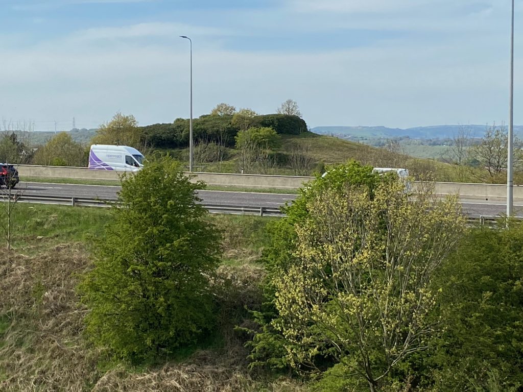
Officially known as Toothill Lane, the track is bisected by the M62 motorway, which was officially opened on the 14th October 1971 by Her Majesty Queen Elizabeth II. The southern section is now called Toothill Lane South, which exits from Clough Lane adjacent to the Four Sons Public House, formerly known as the Clough House Inn.
It has been closed to ‘through traffic’ for over 50 years now but it is still a popular route for walkers, particularly those with dogs, as the path from the south crosses pleasant fields towards the Fixby crematorium. A footbridge carries the footpath over the M62 with spectacular views towards Round Hill and the Southowram hills in the distance, with Brighouse down below. The path then continues down to a stile where many people will know of the Asa Farrargravestone myth. This leads back onto New Dick, eventually meeting up with the road at the top of Toothill Bank with views over Carr Green and beyond to the left hand side.
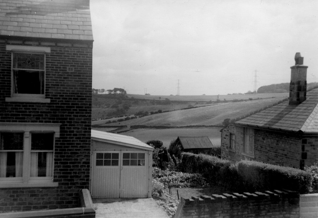
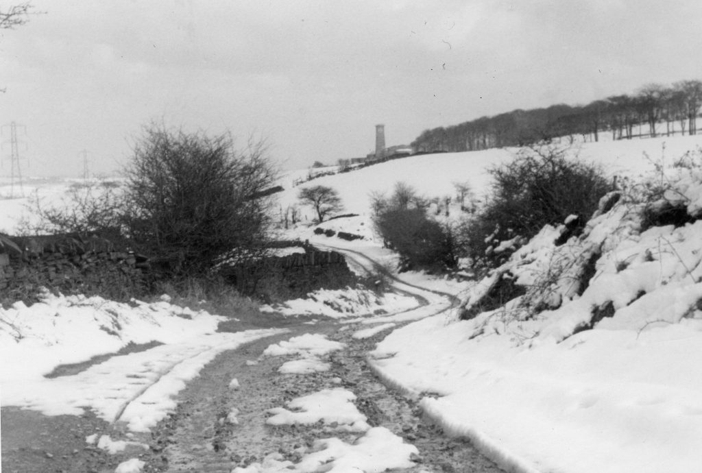
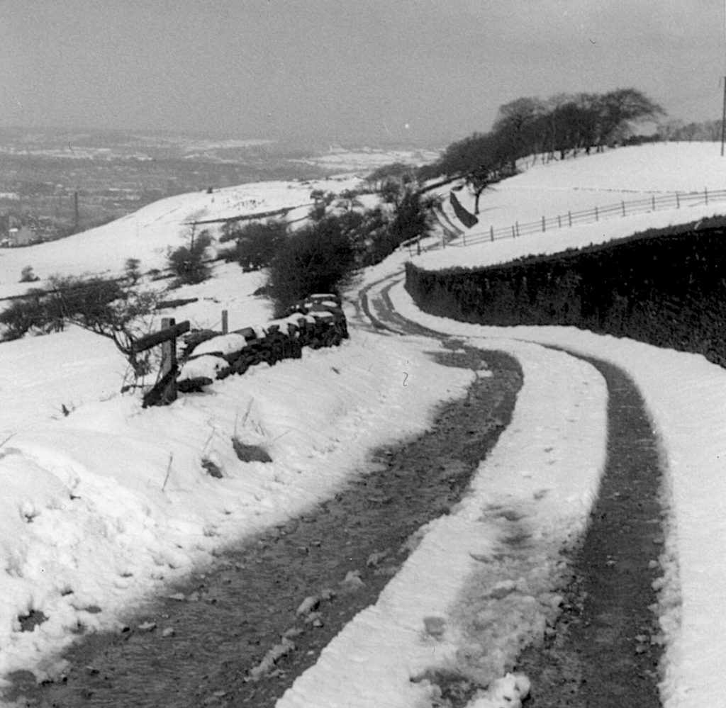
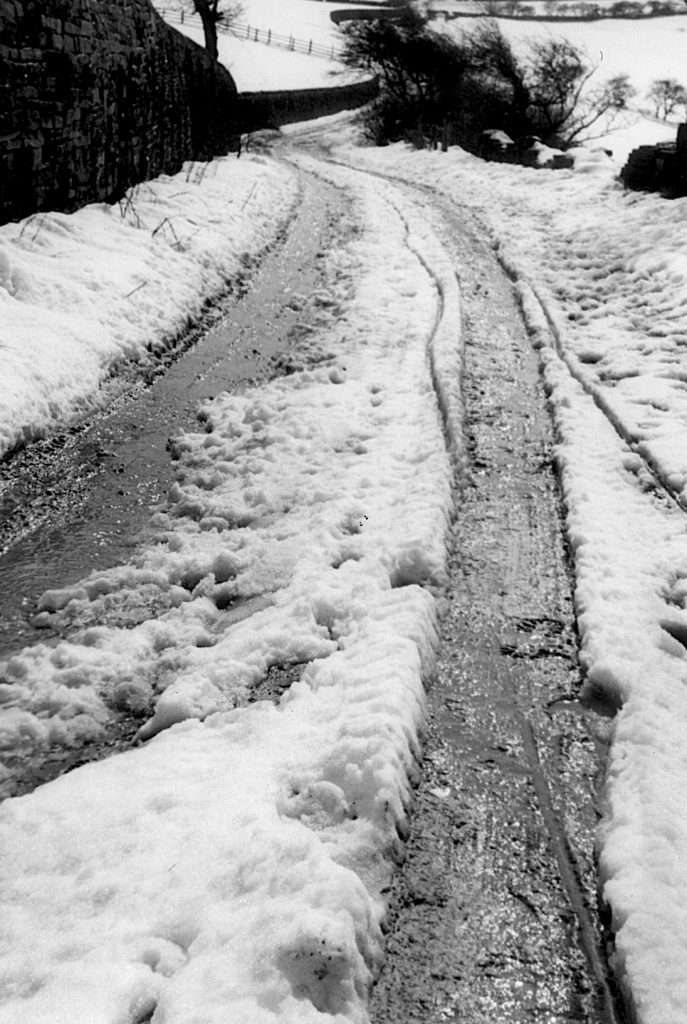
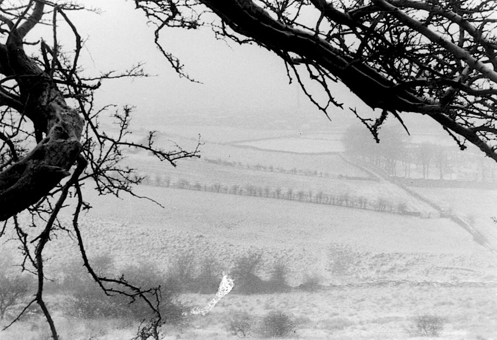
In the winter of 1964-65, a Rastrick student, Stan Holroyd, came home from university for the Christmas holidays. He stayed with his parents at the family home on Slade Lane. The house had wonderful views from the upstairs window over the fields at Carr Green and up to the top of Toothill Bank towards New Dick. These are now partially obscured by houses on the Carr Green estate.
Before the end of the holidays, a large snowfall had descended upon Rastrick. Stan set out, armed with his camera, to shoot some pictures of the winter wonderland scene along the New Dick. The hawthorn hedgerows have been left to run nature’s course and many have since grown into mature trees, blocking out the views that Stan photographed that day. It is impossible to take comparison pictures from the same location as Stan’s shots because the lane has altered so much with the building of the M62.
The view from Stan’s house on Slade Lane towards New Dick. This view is now obstructed by houses on the Carr Green estate.
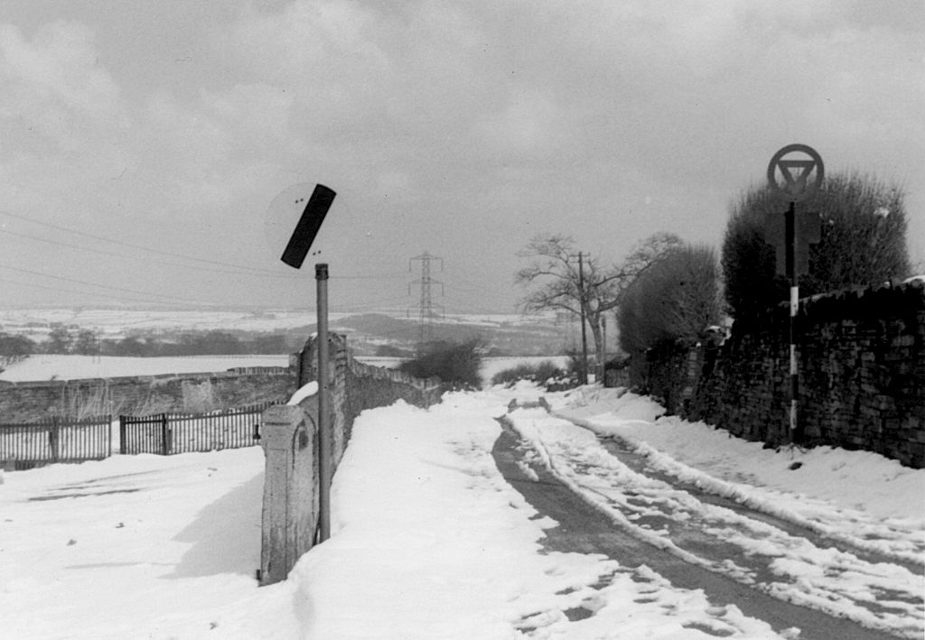
The entrance to New Dick from Clough Lane with the car park of the Clough House Inn to the left. The derestricted speed limit sign on the left means that traffic can legally travel along the road at 60 mph ! Note the old style give way sign on the right for traffic approaching Clough Lane.
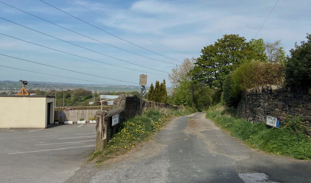
The modern day photograph below shows that little has changed at this location until you look over the fence to the left where the M62 has now created a new boundary between the Calderdale and Kirklees local authorities.
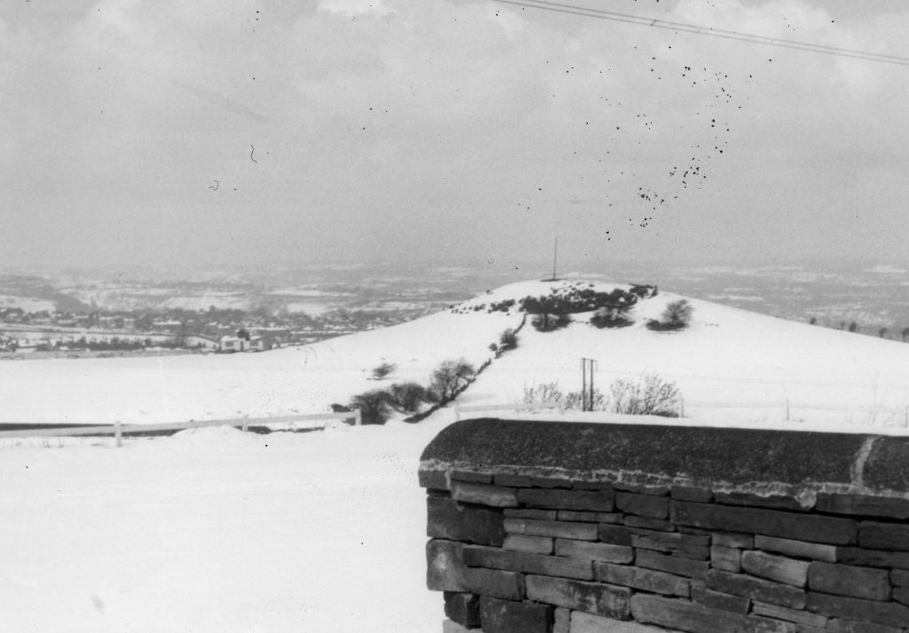
Another view from the Clough House Inn car park looking towards Round Hill. There was always a flag pole at the top of the mound but this was removed after it was vandalised. There are a lot more rhododendron bushes nowadays but these original shrubs were planted in 1912 by Arthur Charles Lane, headmaster at Carr Green School and the grandfather of Charles Squire who many will remember as the master baker at Squire’s bread shop on Briggate, Brighouse until recent years. How many of you can you remember the changing rooms and scorebox in the old cricket pavilion at Rastrick Cricket Club which is visible in the distance at the foot of the slope. The scene looks very different now as the busy M62 motorway runs from left to right between the wall and edge of the cricket field.
Below is another modern photo from close by to where Stan’s photo was taken. The actual top of Round Hill is obscured by the rhododendron bushes and the M62 running between the pub and the hill.
Travelling from Clough Lane, New Dick sweeps around to the left to a point where it now becomes a dead-end as the motorway bisects the track. The chimney of the fairly new Fixby Crematorium can be seen at the end of the tree lined driveway from Fixby Road. The original crematorium was destroyed in an explosion on the 3rd August 1981 but was rebuilt in a similar style to the present building. The sloping field from the driveway is now partial woodland.
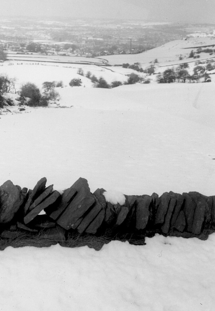
This photograph is taken from roughly where the M62 now travels from left to right. It is looking down on Toothill Bank to the left of the track whilst to the right is a field called Lower High Field. This name is taken from the 1824 Rastrick map in Rastrick Library. You can just make out a path through the field from the trees in the distance to the wooden fence. This path is also shown on the 1824 map but now brings walkers up to the footbridge over the motorway.
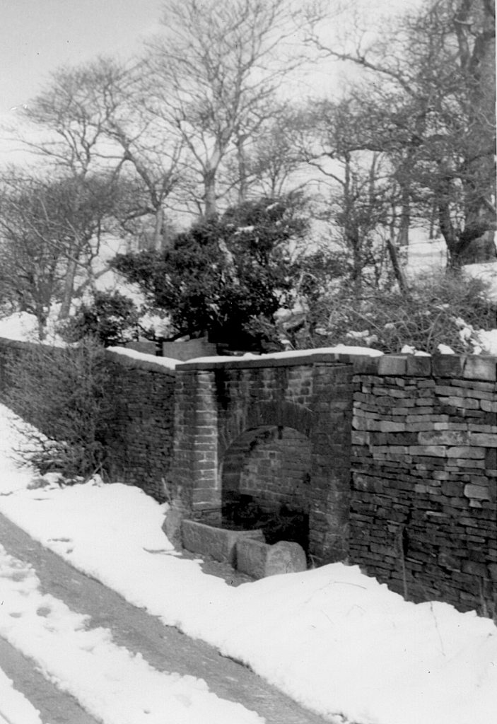
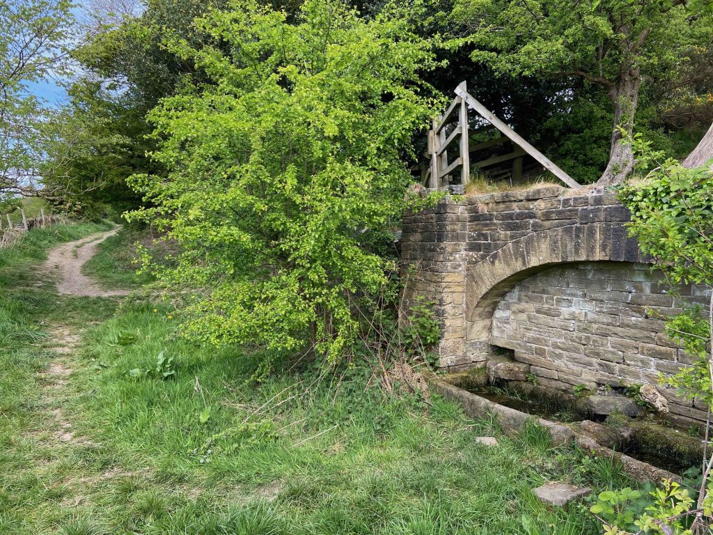
Stan continued his walk down towards the distant tree line where there are two water troughs built into the right hand wall and where the Asa Farrar ‘gravestone’ is located (more on Asa Farrar can be found on this website). At this point, he turned around back in the direction of the Clough House and took the photograph below.
The wooden fence on the left is the same as the one in the photograph above. The M62 now runs from left to right just beyond this fence.
Turning back around again and facing towards Toothill, Stan took this wonderful photo of the water troughs. They are set inside an ornate stone arch that forms part of the wall, with Lower High Field on the other side. The entrance into the field is hidden by the shrub just beyond. Unfortunately, the wall toppings have now gone from above the troughs and the wall is falling into disrepair. This is not helped by the trees growing on either side.
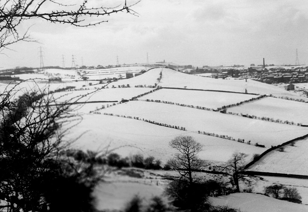
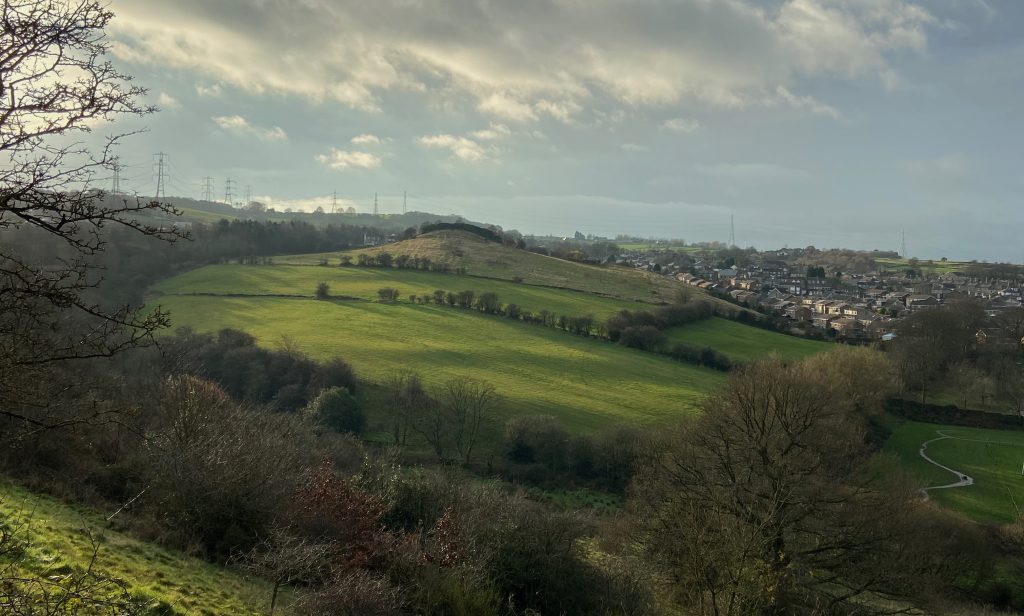
Stan took another photo from around this area, looking down the valley and across towards Round Hill. You can make out the water pumping station just above the top of Round Hill. This is located ‘up ridge’ towards Ainley Top on New Hey Road. To the right of Round Hill are the houses at the ‘top end’ of Rastrick. John Smith’s chimney at Badger Hill Mills on Dewsbury Road is the black upright just below the horizon. The mill was partially destroyed by fire in 1970 after which a crack appeared in the chimney. A firm from Bradford was brought in to safely demolish it but they miscalculated. The chimney fell through the spinning shed roof which was the only part of the mill unaffected by the fire. This disastrous incident brought about the demise of the company.
Looking at this same scene today, some of the boundary hedges and walls have been removed to create larger fields, as can be seen on the photo below but farming still takes place on the lower slopes of the Round Hill leading down to Carr Green. Also gone from the older photograph is the building below the left hand pylon. This was the old service garage on Clough Lane, complete with its own petrol pump. People who remember the garage are diminishing fast!
The above photo is looking down from New Dick to the fields at the foot of Round Hill near to Carr Green. There is nothing too spectacular about it until you look closely. On the centre right of the photo is a triangular shaped section of field. This is the Carr Green recreation ground or ‘the rec’ as it was known to everyone in the area. Beyond the wall at the top side of the field is Rastrick Cemetery, surrounded by trees on two visible sides. On the left wall of the cemetery there is a narrow track leading to another field which Stan says was used as the cricket filed for Rastrick Grammar School whilst the hazy field beyond that was the school football field. The track is still accessible through a gate in the top corner of the rec. but it is now fairly overgrown although the walls on either side are still standing. During the late 1960’s the track formed part of the grammar school cross country course which led onto the then recently developed Carr Green Drive. If you walk along the track now. it brings you to the back gardens of house on Carr Green Drive. Here it forms a ‘T junction’, the left side leading into the fields and up Round Hill whilst turning right takes you between Carr Green Drive and the western wall of the cemetery. It eventually brings you out on Carr Green lane opposite the tennis club.
Another ‘looking down’ photo and yet another mill chimney. This view is towards Brighouse in the bottom of the valley and the mill chimney is that of Walshaw Drakes at Rosemary Works between Rastrick Common and Thornhill Road. The mill dam was filled by the stream running past Carr Green, under Quarry Road and through the golf course. A little known fact was that the water also helped to fill the public baths in that location from the late 1700’s. A few people have asked about the baths and they were nothing more than elaborate outdoor stone troughs where the great unwashed of lower Rastrick could clean themselves after a days toil in the local quarries.
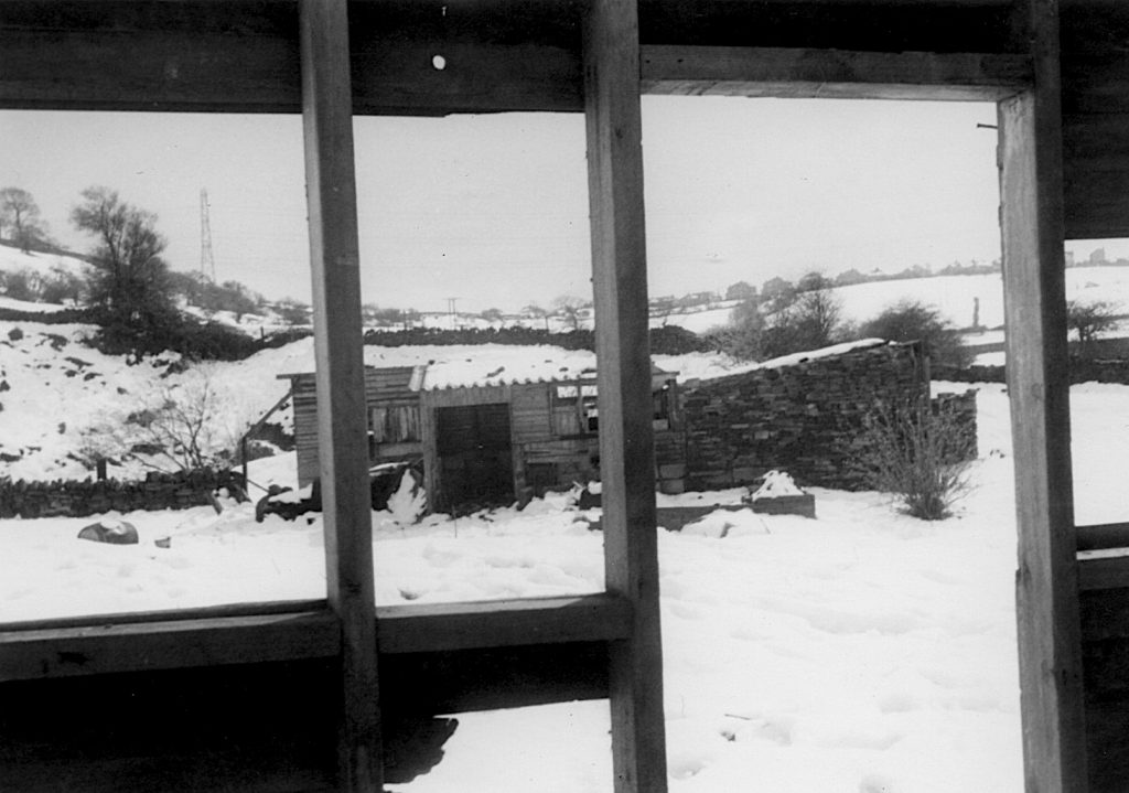
Upon reaching the Toothill end of New Dick, Stan made his way down towards Carr Green. Just over the stream at the bottom of the steep hillside, where countless generations have enjoyed sledging in the winter months and paddling in the water during the summer, there was a small holding where a man by the name of Gordon Riach kept some pigs. Roger Thompson, a local man, recalls Gordon driving up Quarry Road from the bottom of Toothill Bank in an old clapped out black coloured Vauxhall car. This is something that would be impossible nowadays due to the overgrown state of Quarry Road. On the day that Stan visited the old buildings, the pigs had gone and the place was falling apart. It was soon afterwards swept into the annals of history and is now just a distant memory to a few Rastrickians of a certain age.
On the photo above, the banking at Toothill is on the left with New Dick perched above. Looking straight ahead today, you will see the M62 motorway on its lofty perch whilst Carr Green rec. is just over the dry stone wall to the right.
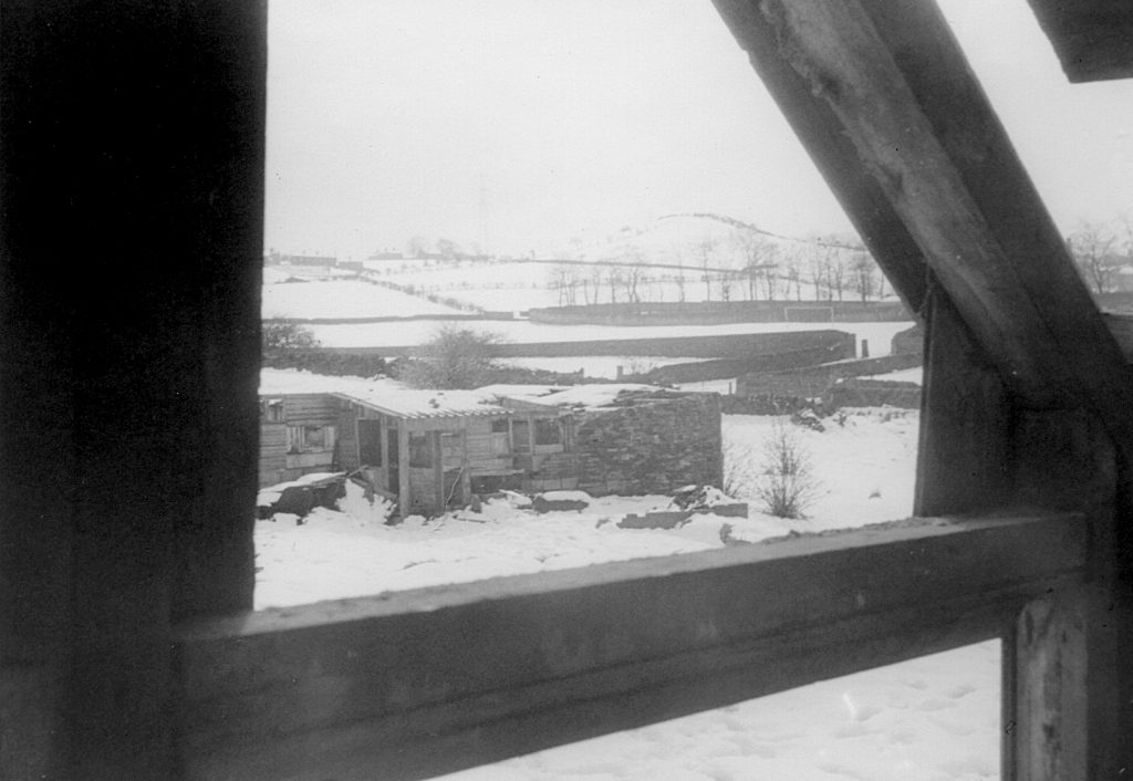
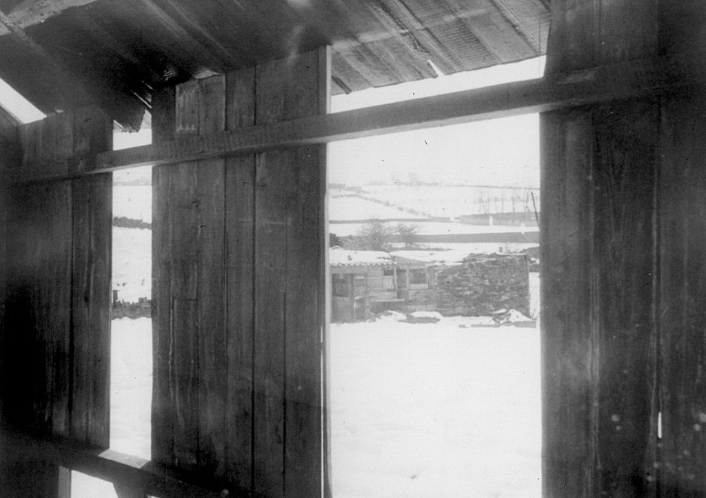
Stan must have fancied himself as a budding professional photographer as he experimented with framing his photos with the old window frames of Riach’s dilapidated piggery.
On this photo, Stan has captured a view up towards Round Hill, a scene that isn’t possible today because of the obstructed view caused by trees. You can make out the goalposts on the rec. against the dark coloured wall of the cemetery, lined by leafless trees. The photo below is from a slightly different angle but very similar.
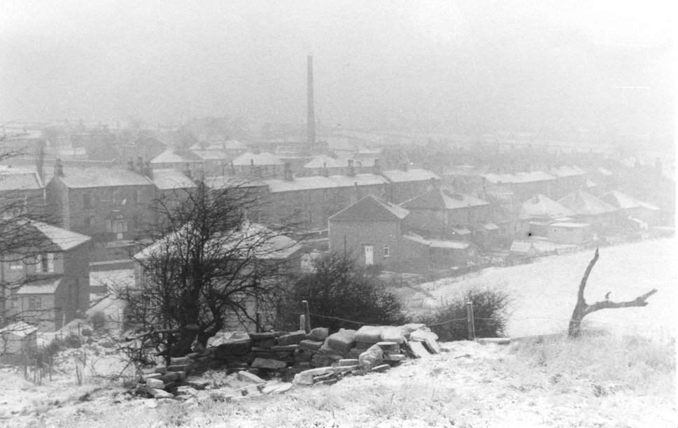
The final photograph below is taken from near to the cricket pavilion and score box at Rastrick Cricket Club, looking down onto Slade Lane. Note the mill chimney from Spout Mills in the distance. One of several chimneys in Rastrick at that time but all are now just a memory.
Stan says that there is a story about the flat area behind the pavilion which is shown on this photo with a low wall around it. His father told him that it was flattened by Stan’s Grandad Ratcliffe and his brother Walter. He doesn’t know if they were paid for the work or whether they did it voluntarily but thinks the intention was to eventually build a bowling green. The job was never finished because after the brothers had laboured all day, for the benefit of the club, they went into the bar of the clubhouse hoping to get at least one pint of ale on the house but they were refused. A big fall out resulted and the lads didn’t go back and so the job was never finished.
Thanks to Stan for having the foresight to take these photos of an area known and loved by many. It was an area where I used to play with friends and go out for Sunday afternoon walks with my parents and brothers. I still walk in that area on a regular basis so I am grateful to him for giving me the opportunity to reflect upon what it used to look like ‘when I was a lad’.